
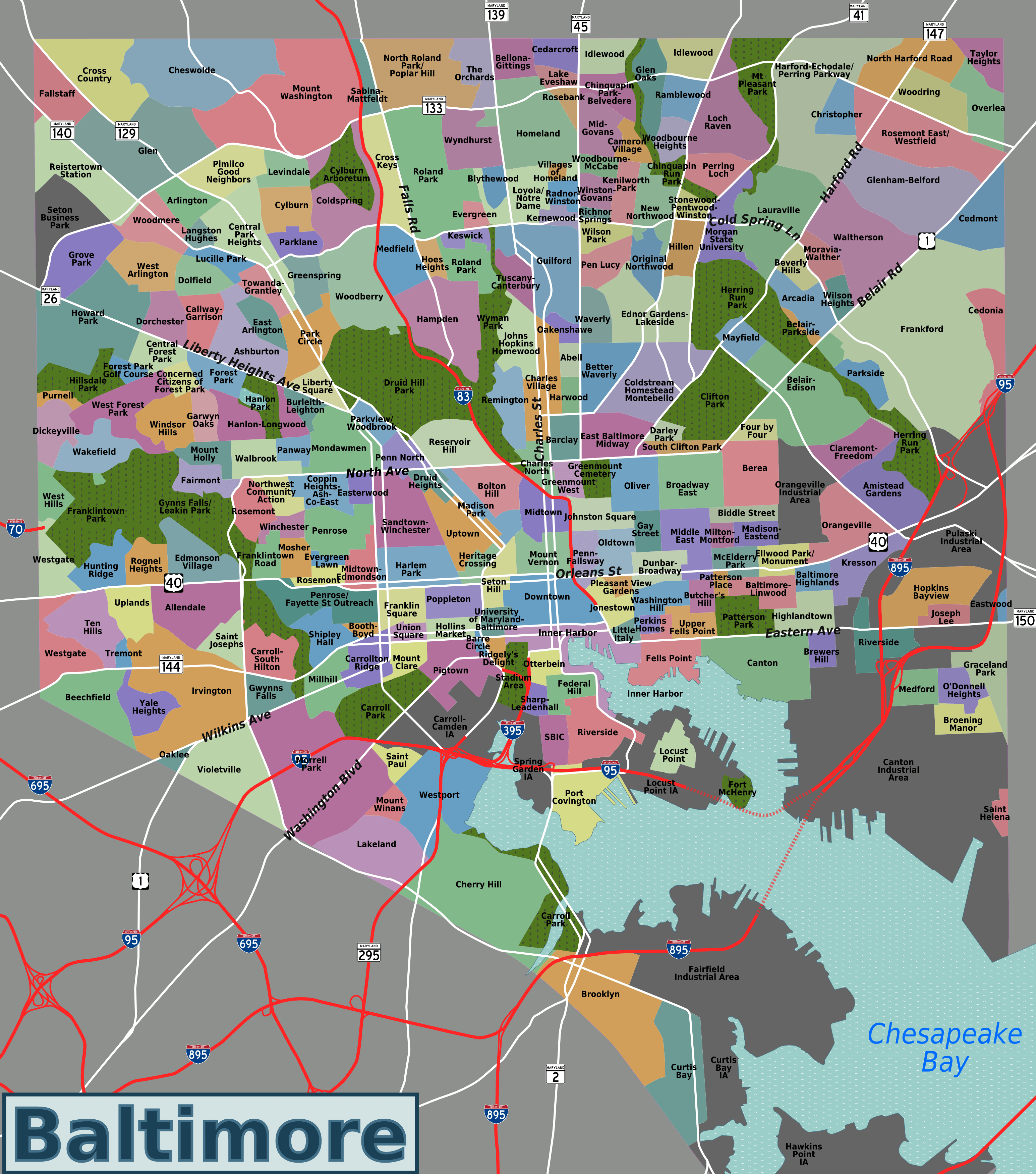
Image: Baltimore neighborhoods map
Size of this preview: 529 × 599 pixels. Other resolutions: 212 × 240 pixels | 3,090 × 3,500 pixels.
Original image (3,090 × 3,500 pixels, file size: 2.92 MB, MIME type: image/png)
Description: Map of Baltimore's neighborhoods, with official city-designated boundaries accurate to street level.
Title: Baltimore neighborhoods map
Credit: self created, traced from OpenStreetMap
Author: Peter Fitzgerald, OpenStreetMap
Usage Terms: Creative Commons Attribution-Share Alike 3.0
License: CC BY-SA 3.0
License Link: http://creativecommons.org/licenses/by-sa/3.0
Attribution Required?: Yes
Image usage

All content from Kiddle encyclopedia articles (including the article images and facts) can be freely used under Attribution-ShareAlike license, unless stated otherwise.