
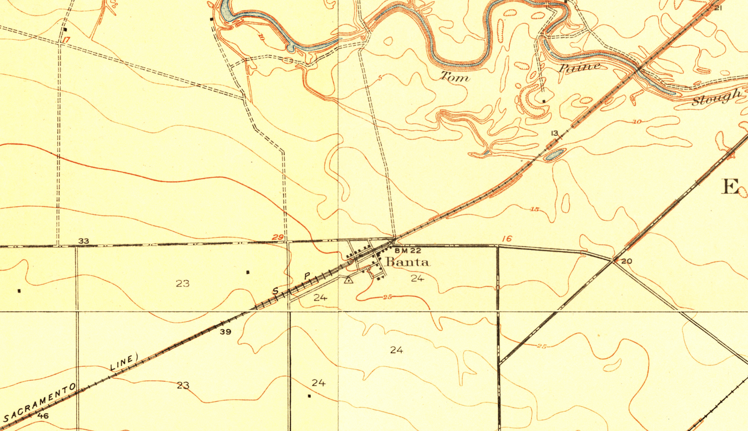
Image: Banta, California Map (USGS Composite, Circa 1915)
Size of this preview: 800 × 461 pixels. Other resolutions: 320 × 185 pixels | 1,519 × 876 pixels.
Original image (1,519 × 876 pixels, file size: 991 KB, MIME type: image/png)
Description: A map of Banta, California. The map is a composite of four historical USGS quadrant maps: Union Island (1914, top left), Tracy (1916, bottom left), Vernalis (1915, bottom right), and Lathrop (1915, top right).
Title: Banta, California Map (USGS Composite, Circa 1915)
Credit: Own work
Author: BayRadioDJ
Usage Terms: Creative Commons Attribution-Share Alike 4.0
License: CC BY-SA 4.0
License Link: https://creativecommons.org/licenses/by-sa/4.0
Attribution Required?: Yes
Image usage
The following page links to this image:

All content from Kiddle encyclopedia articles (including the article images and facts) can be freely used under Attribution-ShareAlike license, unless stated otherwise.
.png)