
Image: Bayshore Cutoff map

Size of this PNG preview of this SVG file: 378 × 599 pixels. Other resolution: 151 × 240 pixels.
Original image (SVG file, nominally 1,200 × 1,900 pixels, file size: 3.66 MB)
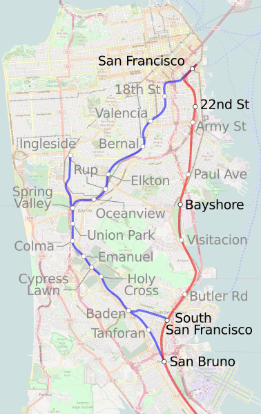
Description: Map showing the route of the Bayshore Cutoff (completed in 1907) and the prior route established by the SF&SJ RR in 1863 (renamed to the Ocean View route), through the Bernal Cut along much of what is now San Jose Avenue in San Francisco today.
Title: Bayshore Cutoff map
Credit: Own work
Author: Mliu92
Usage Terms: Creative Commons Attribution-Share Alike 4.0
License: CC BY-SA 4.0
License Link: https://creativecommons.org/licenses/by-sa/4.0
Attribution Required?: Yes
Image usage
The following page links to this image:

All content from Kiddle encyclopedia articles (including the article images and facts) can be freely used under Attribution-ShareAlike license, unless stated otherwise.