
Image: Beginning Point of the U.S. Public Land Survey front
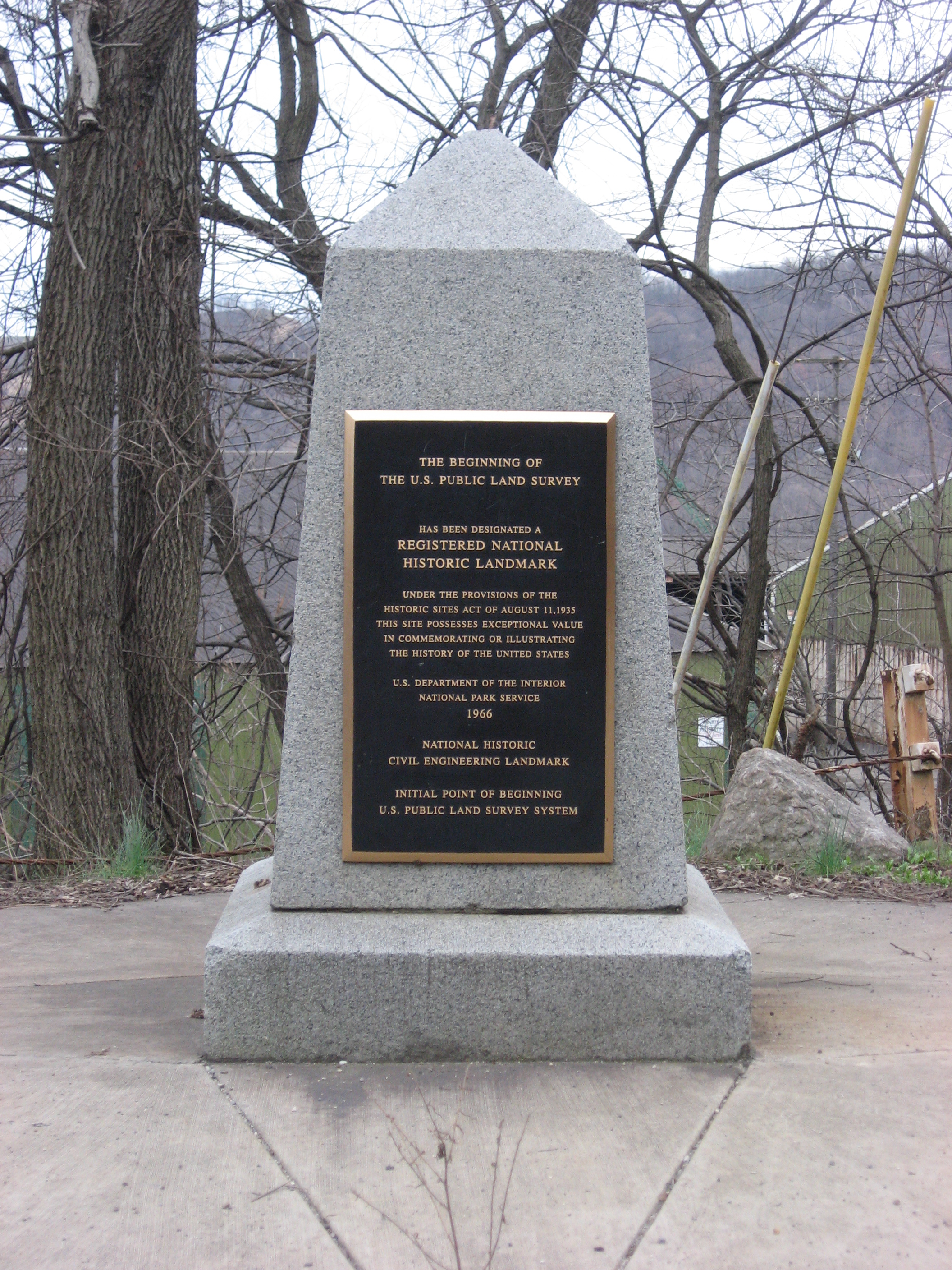
Description: Streetside view of the Beginning Point of the U.S. Public Land Survey, a monument marking the site that served as the basis for the entire Public Land Survey System — the system by which most of the United States, outside of the original colonies, was surveyed. Located on the Ohio/Pennsylvania border east of downtown East Liverpool, Ohio, it is split between the city of East Liverpool and the borough of Ohioville in Beaver County, Pennsylvania. Erected in 1881 by a joint commission of Ohio and Pennsylvania surveyors, the monument was declared a National Historic Landmark in 1966. The road on which it lies is Ohio State Route 39 and Pennsylvania Route 68.
Title: Beginning Point of the U.S. Public Land Survey front
Credit: Own work
Author: User:Nyttend
Permission: I, the copyright holder of this work, release this work into the public domain. This applies worldwide. In some countries this may not be legally possible; if so: I grant anyone the right to use this work for any purpose, without any conditions, unless such conditions are required by law.
Usage Terms: Public domain
License: Public domain
Attribution Required?: No
Image usage
The following 8 pages link to this image:
- Beginning Point of the U.S. Public Land Survey
- List of National Historic Landmarks in Ohio
- List of National Historic Landmarks in Pennsylvania
- List of Pennsylvania state historical markers in Beaver County
- List of U.S. National Historic Landmarks by state
- List of municipalities in Pennsylvania
- National Register of Historic Places listings in Beaver County, Pennsylvania
- National Register of Historic Places listings in Columbiana County, Ohio
