
Image: Belte inter
No higher resolution available.
Belte_inter.png (566 × 600 pixels, file size: 681 KB, MIME type: image/png)
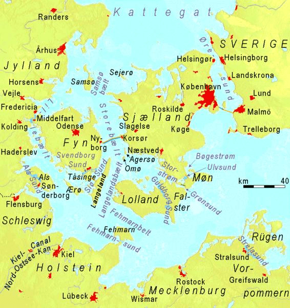
Description: Straits named Belt or Sund in denmark and southern Baltic Sea. To keep the straits visible, only the longest bridges (orange), tunnels (dark blue) and dams (dark green) are marked
Title: Belte inter
Credit: http://www.maps-for-free.com (Google maps)
Author: Ulamm 18:32, 26 January 2008 (UTC)
Usage Terms: Creative Commons Attribution-Share Alike 3.0
License: CC BY-SA 3.0
License Link: http://creativecommons.org/licenses/by-sa/3.0
Attribution Required?: Yes
Image usage
The following 2 pages link to this image:

All content from Kiddle encyclopedia articles (including the article images and facts) can be freely used under Attribution-ShareAlike license, unless stated otherwise.