
Image: Berkshire UK location map

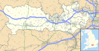
Description: Map of Berkshire, UK with the following information shown: Administrative borders Coastline, lakes and rivers Roads and railways Urban areas Equirectangular map projection on WGS 84 datum, with N/S stretched 160% Geographic limits: West: 1.63W East: 0.46W North: 51.59N South: 51.21N
Title: Berkshire UK location map
Credit: Ordnance Survey OpenData. Administrative borders and coastline data from Boundary-Line product. All other geographic data from Meridian 2 product. Inset derived from England location map.svg by Spischot.
Author: Nilfanion, created using Ordnance Survey data
Permission: This file is licensed under the Creative Commons Attribution-Share Alike 3.0 Unported license. Attribution: Contains Ordnance Survey data © Crown copyright and database right You are free: to share – to copy, distribute and transmit the work to remix – to adapt the work Under the following conditions: attribution – You must give appropriate credit, provide a link to the license, and indicate if changes were made. You may do so in any reasonable manner, but not in any way that suggests the licensor endorses you or your use. share alike – If you remix, transform, or build upon the material, you must distribute your contributions under the same or compatible license as the original. https://creativecommons.org/licenses/by-sa/3.0 CC BY-SA 3.0 Creative Commons Attribution-Share Alike 3.0 truetrue
Usage Terms: Creative Commons Attribution-Share Alike 3.0
License: CC BY-SA 3.0
License Link: https://creativecommons.org/licenses/by-sa/3.0
Attribution Required?: Yes
Image usage
The following 42 pages link to this image:
- Ascot, Berkshire
- Beaumys Castle
- Beech Hill, Berkshire
- Bisham
- Bracknell
- Bussock Camp
- Caversham, Reading
- Church of St Mary the Virgin, Aldermaston
- Crowthorne
- Deadwater Ait
- Donnington Castle
- Earley
- Englefield, Berkshire
- Eton, Berkshire
- Firework Ait
- Friday Island, River Thames
- Hampstead Norris Castle
- Hungerford
- Inkpen Common
- King George VI Memorial Chapel
- Legoland Windsor Resort
- Lion Island (Old Windsor)
- Magna Carta Island
- Maidenhead
- Monkey Island, Bray
- Newbury, Berkshire
- Newbury Castle
- Odney
- Perborough Castle
- Romney Island
- Sandhurst, Berkshire
- Slough
- St Laurence's Church, Upton-cum-Chalvey
- Sunningdale
- Sunninghill, Berkshire
- Thatcham
- Windsor, Berkshire
- Windsor Safari Park
- Wokingham
- Woodley, Berkshire
- Yattendon Castle
- Yeomanry House, Reading
