
Image: Bermondsey Met. B Ward Map 1916

Size of this PNG preview of this SVG file: 800 × 536 pixels. Other resolution: 320 × 214 pixels.
Original image (SVG file, nominally 1,222 × 819 pixels, file size: 75 KB)
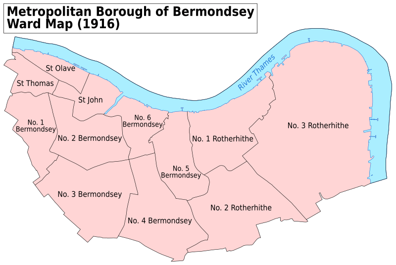
Description: A map showing the wards of Bermondsey Metropolitan Borough as they appeared in 1916. Based on the Ordnance Survey 'County Series 3rd Edition' Map of London (1912-14) Sheets V12, V15, V16, IX3 & IX4 at 1:2500 scale. Accessed at http://maps.nls.uk/index.html Reproduced with the permission of the National Library of Scotland. Key: District Boundaries River bank River
Title: Bermondsey Met. B Ward Map 1916
Credit: Own work
Author: Doc77can
Usage Terms: Creative Commons Attribution-Share Alike 4.0
License: CC BY-SA 4.0
License Link: http://creativecommons.org/licenses/by-sa/4.0
Attribution Required?: Yes
Image usage
The following 5 pages link to this image:

All content from Kiddle encyclopedia articles (including the article images and facts) can be freely used under Attribution-ShareAlike license, unless stated otherwise.