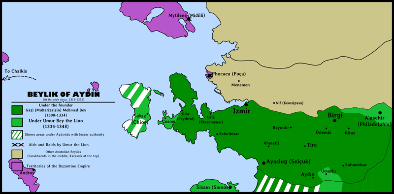
Image: Beylik of Aydın 1315-1375

Description: Beylik of Aydın(Aydınids)'s map during its peak years between 1315 and 1375. Beylik of Aydın Map highlighting: Borders under Gazi Mehmed Bey Borders after conquests under Umur Bey the Lion Byzantine Empire territories Other Western Anatolian Beyliks Black "X" showing Umur Bey's aids Red "X" showing Umur Bey's raids
Title: Beylik of Aydın 1315-1375
Credit: Own work
Author:
Permission: This file (map · collage · logo · graphic · etc.) is a part of the Project: . You are free to reuse this work for any purpose as long as you credit Berkaysnklf and follow the terms of the license listed below. See also: Turkey Project Page. This work was composed by . You are free to reuse this work for any purpose as long as you credit Berkaysnklf and follow the terms of the license listed below. See also: Berkaysnklf Profile Page.
Usage Terms: Creative Commons Attribution 4.0
License: CC BY 4.0
License Link: https://creativecommons.org/licenses/by/4.0
Attribution Required?: Yes
Image usage
The following page links to this image:

