
Image: BigSurMap3
Size of this preview: 454 × 599 pixels. Other resolutions: 182 × 240 pixels | 536 × 707 pixels.
Original image (536 × 707 pixels, file size: 94 KB, MIME type: image/png)
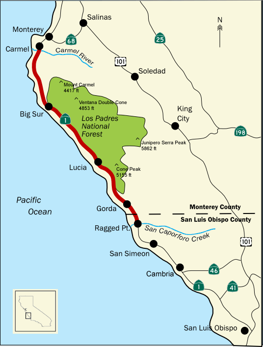
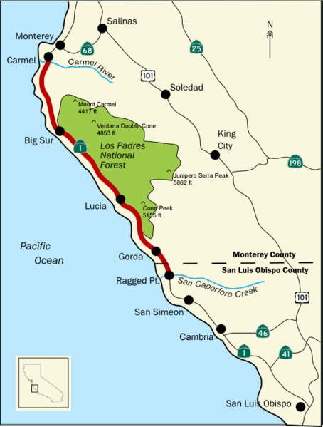
Description: Map of the Big Sur coast region, and the northern section of Los Padres National Forest, in the California Coast Ranges of central California. Western central California. Credits slight modification of previous file version - added location of Cambria
Title: BigSurMap3
Credit: Transferred from en.wikipedia to Commons by knuckles.
Author: The original uploader was Scooterboss at English Wikipedia
Usage Terms: Creative Commons Attribution-Share Alike 3.0
License: CC-BY-SA-3.0
License Link: http://creativecommons.org/licenses/by-sa/3.0/
Attribution Required?: Yes
Image usage
There are no pages that link to this image.

All content from Kiddle encyclopedia articles (including the article images and facts) can be freely used under Attribution-ShareAlike license, unless stated otherwise.