
Image: Big Runaway Map
No higher resolution available.
Big_Runaway_Map.PNG (493 × 357 pixels, file size: 20 KB, MIME type: image/png)
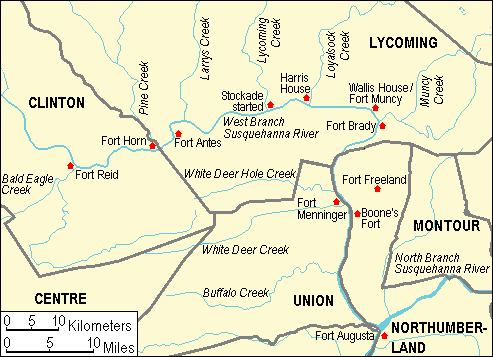
Description: Map of Fortifications in north central Pennsylvania, United States during the Big Runaway and Little Runaway, 1778-1779
Title: Big Runaway Map
Credit: taken from US Census website [1] and modified by User:Ruhrfisch.
Author: US Census, Ruhrfisch
Permission: US Census / US Government work is public domain, my modifications licensed under the GNU Free Documentation License
Usage Terms: Creative Commons Attribution-Share Alike 3.0
License: CC-BY-SA-3.0
License Link: http://creativecommons.org/licenses/by-sa/3.0/
Attribution Required?: Yes
Image usage
The following 6 pages link to this image:

All content from Kiddle encyclopedia articles (including the article images and facts) can be freely used under Attribution-ShareAlike license, unless stated otherwise.