
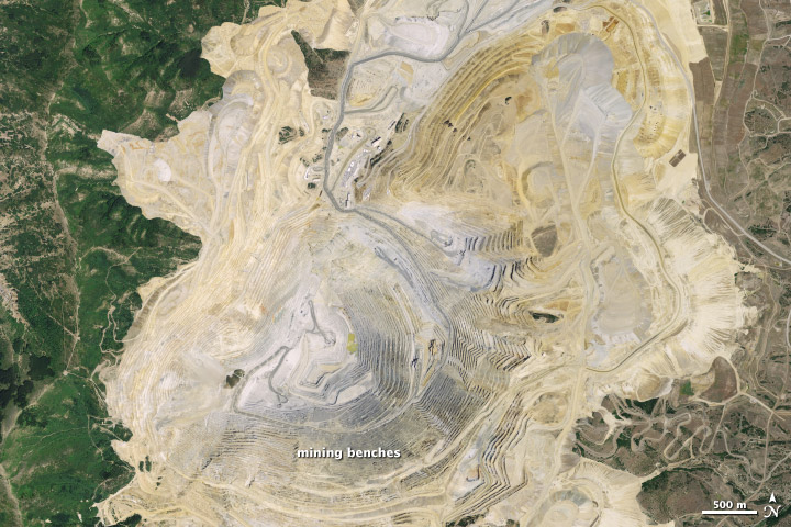
Image: Bingham Canyon Mine Satellite image before Landslide
No higher resolution available.
Bingham_Canyon_Mine_Satellite_image_before_Landslide.jpg (720 × 480 pixels, file size: 142 KB, MIME type: image/jpeg)
Description: Bingham Canyon Mine Satellite image before Landslide acquired on July 20, 2011
Title: Bingham Canyon Mine Satellite image before Landslide
Credit: http://earthobservatory.nasa.gov/NaturalHazards/view.php?id=81364&src=eorss-nh
Author: NASA Earth Observatory image by Jesse Allen and Robert Simmon
Usage Terms: Public domain
License: Public domain
Attribution Required?: No
Image usage
The following page links to this image:

All content from Kiddle encyclopedia articles (including the article images and facts) can be freely used under Attribution-ShareAlike license, unless stated otherwise.