
Image: Blackstonevalleymap
No higher resolution available.
Blackstonevalleymap.png (600 × 600 pixels, file size: 138 KB, MIME type: image/png)
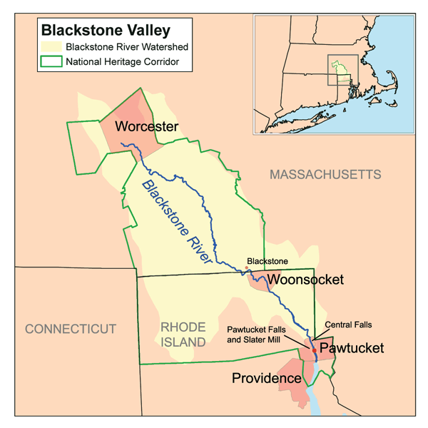
Description: This is a map of the Blackstone Valley. I, Karl Musser, created it based on USGS and Census Bureau data. Additional data was obtained from Rhode Island GIS, copyright RIGIS, used with permission, and from the National Park Service.
Title: Blackstonevalleymap
Credit: No machine-readable source provided. Own work assumed (based on copyright claims).
Author: No machine-readable author provided. Kmusser assumed (based on copyright claims).
Usage Terms: Creative Commons Attribution-Share Alike 2.5
License: CC BY-SA 2.5
License Link: http://creativecommons.org/licenses/by-sa/2.5
Attribution Required?: Yes
Image usage
The following 3 pages link to this image:

All content from Kiddle encyclopedia articles (including the article images and facts) can be freely used under Attribution-ShareAlike license, unless stated otherwise.