
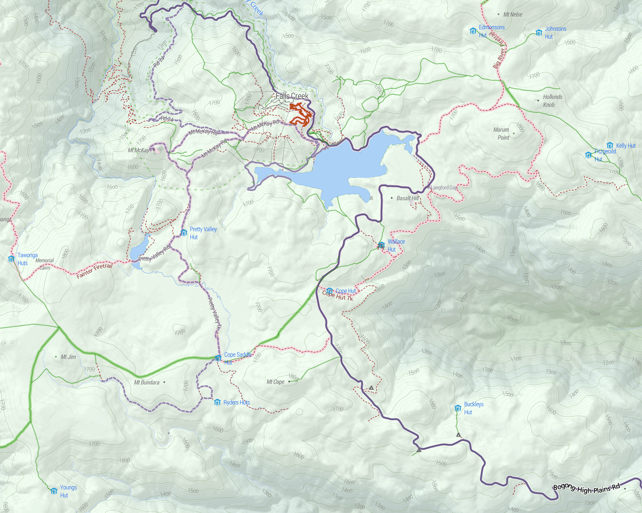
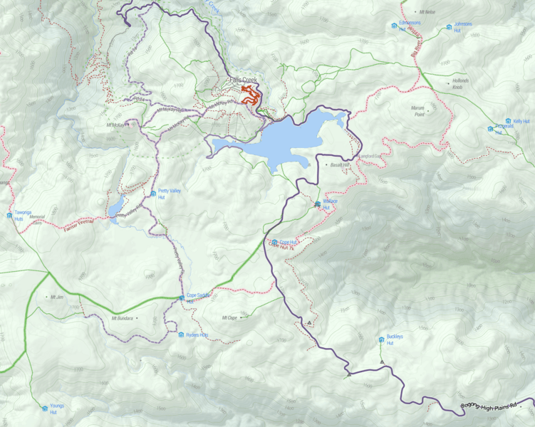
Image: Bogong High Plains map Stevage
Size of this preview: 751 × 600 pixels. Other resolutions: 301 × 240 pixels | 2,104 × 1,680 pixels.
Original image (2,104 × 1,680 pixels, file size: 3.71 MB, MIME type: image/png)
Description: Topographic Map of the Bogong High Plains area, showing huts, hiking (green) and mountain biking (pink) paths. Cartography by Steve Bennett Map data is OpenStreetMap.
Title: Bogong High Plains map Stevage
Credit: Own work
Author: Stevage
Usage Terms: Creative Commons Attribution-Share Alike 4.0
License: CC BY-SA 4.0
License Link: https://creativecommons.org/licenses/by-sa/4.0
Attribution Required?: Yes
Image usage
The following page links to this image:

All content from Kiddle encyclopedia articles (including the article images and facts) can be freely used under Attribution-ShareAlike license, unless stated otherwise.