
Image: Bostonharbourtopomap

Size of this preview: 800 × 458 pixels. Other resolutions: 320 × 183 pixels | 1,278 × 732 pixels.
Original image (1,278 × 732 pixels, file size: 2.19 MB, MIME type: image/png)
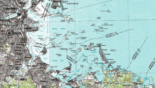
Description: Topographical map of Boston Harbour. Captured from NASA World Wind, map by USGS.
Title: Bostonharbourtopomap
Usage Terms: Public domain
License: Public domain
Attribution Required?: No
Image usage
The following page links to this image:

All content from Kiddle encyclopedia articles (including the article images and facts) can be freely used under Attribution-ShareAlike license, unless stated otherwise.