
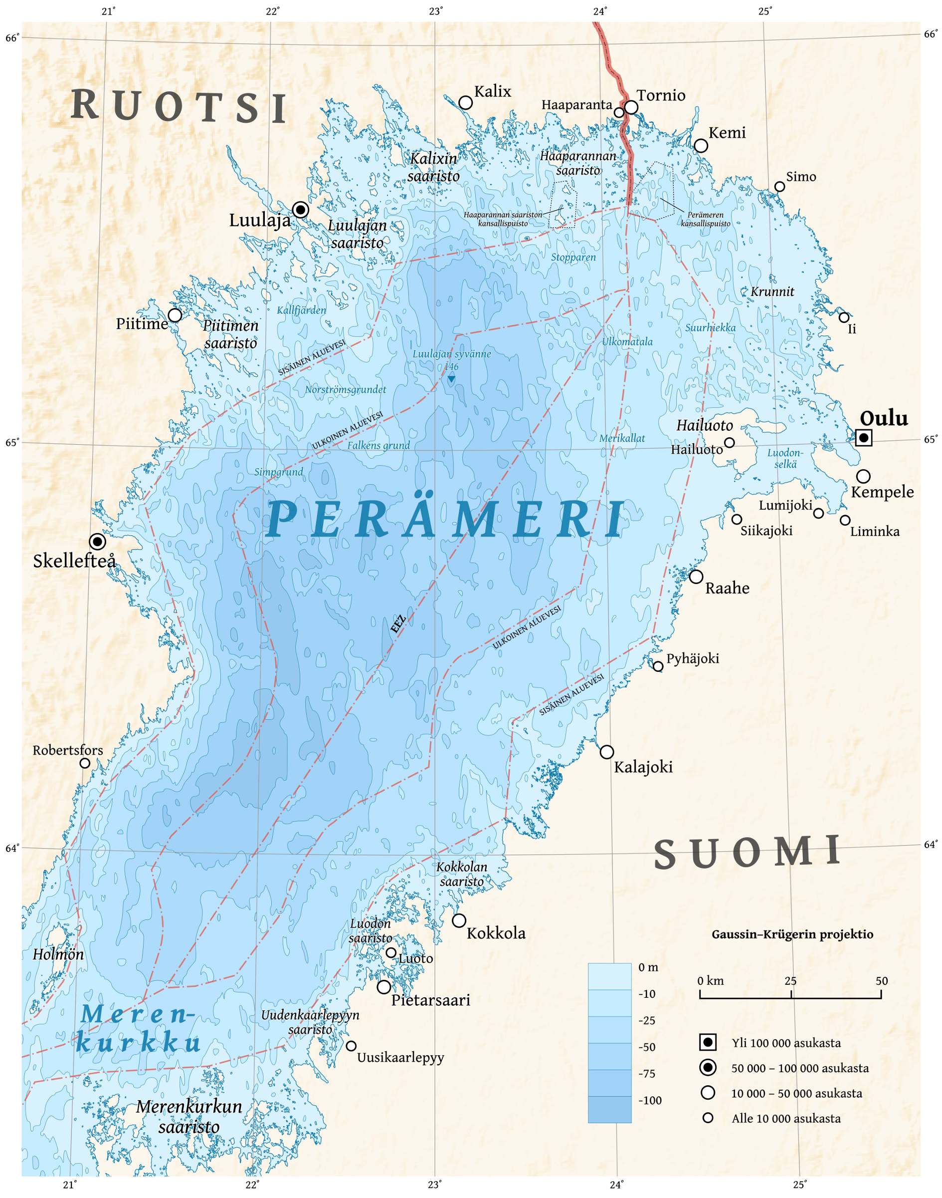
Image: Bothnian Bay map-fi
Size of this preview: 472 × 600 pixels. Other resolutions: 189 × 240 pixels | 1,889 × 2,400 pixels.
Original image (1,889 × 2,400 pixels, file size: 2.94 MB, MIME type: image/png)
Description: Map of the Bothnian Bay in Finnish.
Title: Bothnian Bay map-fi
Credit: Own work using GRASS GIS, Inkscape and GIMP. Data sources: Bathymetry and shade relief are from SRTM30 Plus. Coastlines are simplified subset of the World Vector Shoreline. Exclusive economic are zones from Eurosion. Cities were placed manually using OpenStreetMap as reference. Map projection: Transverse Mercator projection Typeface: Gentium Book Basic from SIL International
Author: Halava
Usage Terms: Creative Commons Attribution-Share Alike 3.0
License: CC BY-SA 3.0
License Link: http://creativecommons.org/licenses/by-sa/3.0
Attribution Required?: Yes
Image usage
The following page links to this image:

All content from Kiddle encyclopedia articles (including the article images and facts) can be freely used under Attribution-ShareAlike license, unless stated otherwise.