
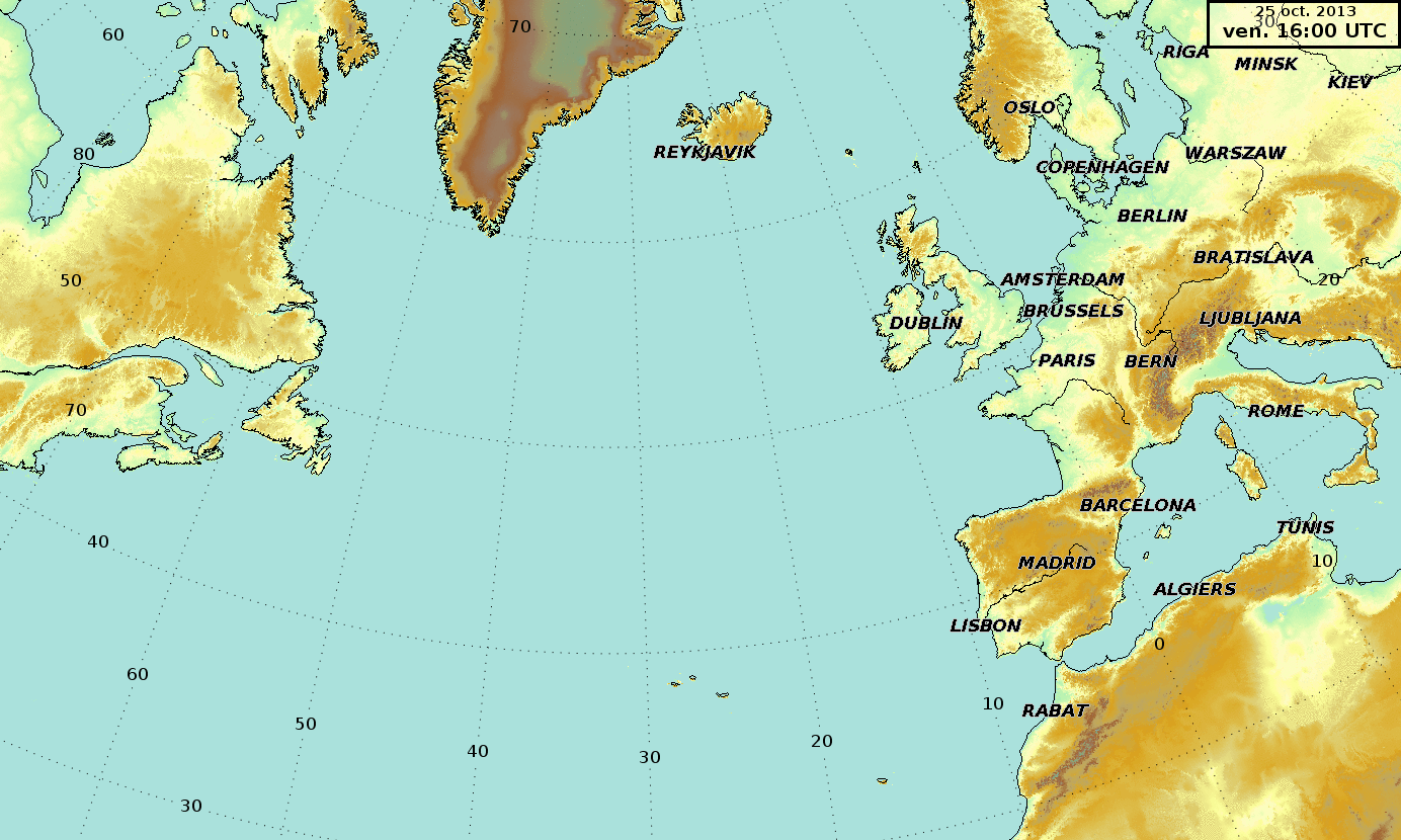
Image: Boucle cartes météo Christian 2013-10-25 29
Size of this preview: 800 × 480 pixels. Other resolutions: 320 × 192 pixels | 1,384 × 830 pixels.
Original image (1,384 × 830 pixels, file size: 5.52 MB, MIME type: image/gif, looped, 15 frames, 7.5 s)
Note: Due to technical limitations, thumbnails of high resolution GIF images such as this one will not be animated.
Description: Loop of meteorological surface map of the trajectory of the St.Jude Storm of 25 to 29 Octobre 2013 (aslo called Christian). Whuile South-Est of Greenland a deeep low pressure called Burkhard is born late on the 25th between Newfoundland and Spain(see : http://www.met.fu-berlin.de/de/wetter/maps/Analyse_20131026.gif). It track rapidly to Southern Great-Britain in and explosive deepening, absorbing Burkhard, and then Northern Europe.
Title: Boucle cartes météo Christian 2013-10-25 29
Credit: Own work
Author: Pierre cb
Usage Terms: Creative Commons Zero, Public Domain Dedication
License: CC0
License Link: http://creativecommons.org/publicdomain/zero/1.0/deed.en
Attribution Required?: No
Image usage
The following page links to this image:

All content from Kiddle encyclopedia articles (including the article images and facts) can be freely used under Attribution-ShareAlike license, unless stated otherwise.