
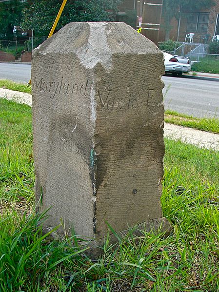
Image: Boundary Stone (District of Columbia) SE 6 (view from north)

Description: Southeast No. 6 Boundary Marker of the Original District of Columbia on the NRHP since November 1, 1996. At 901 Southern Ave., Washington, D.C, as well as being in Prince George's County, Maryland. This is the view from the north, with the text reading "Maryland" on the NE face and "Var. 18' E" on the NW face. "Var 18' E" is the variation of the compass from true north at the marker's location at the time that the stone was put in place.
Title: Boundary Stone (District of Columbia) SE 6 (view from north)
Credit: Own work
Author: Smallbones
Usage Terms: Creative Commons Zero, Public Domain Dedication
License: CC0
License Link: http://creativecommons.org/publicdomain/zero/1.0/deed.en
Attribution Required?: No
Image usage
The following page links to this image:

_SE_6_(view_from_north).jpg)