
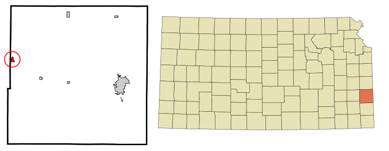
Image: Bourbon County Kansas Incorporated and Unincorporated areas Bronson Highlighted

Size of this PNG preview of this SVG file: 800 × 311 pixels. Other resolution: 320 × 124 pixels.
Original image (SVG file, nominally 900 × 350 pixels, file size: 99 KB)
Description: This map shows the incorporated and unincorporated areas in Bourbon County, Kansas, highlighting Bronson in red. It was created with a custom script with US Census Bureau data and modified with Inkscape.
Title: Bourbon County Kansas Incorporated and Unincorporated areas Bronson Highlighted
Credit: My own work, based on public domain information. Based on similar map concepts by Ixnayonthetimmay
Author: Arkyan
Usage Terms: Creative Commons Attribution-Share Alike 3.0
License: CC-BY-SA-3.0
License Link: http://creativecommons.org/licenses/by-sa/3.0/
Attribution Required?: Yes
Image usage
The following page links to this image:

All content from Kiddle encyclopedia articles (including the article images and facts) can be freely used under Attribution-ShareAlike license, unless stated otherwise.