
Image: Bozcaada map 1
No higher resolution available.
Bozcaada_map_1.jpg (284 × 248 pixels, file size: 18 KB, MIME type: image/jpeg)
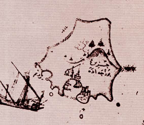
Description: The map was drawn by Ottoman cartographer Piri Reis during 16th century. I've found it in an Italian web site: http://www.capurromrc.it/mappe/!011594darda.html It is flipped for correct orientation and cropped to show the island alone. Filanca 11:46, 10 December 2006 (UTC)
Title: Bozcaada map 1
Usage Terms: Public domain
License: Public domain
Attribution Required?: No
Image usage

All content from Kiddle encyclopedia articles (including the article images and facts) can be freely used under Attribution-ShareAlike license, unless stated otherwise.