
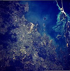
Image: Brisbane Aerial From Satellite

Size of this preview: 593 × 600 pixels. Other resolutions: 237 × 240 pixels | 790 × 799 pixels.
Original image (790 × 799 pixels, file size: 169 KB, MIME type: image/jpeg)
Description: satellite image of the Brisbane Metropolitan Area and surrounding Islands of Moreton Bay
Title: Brisbane Aerial From Satellite
Credit: http://eol.jsc.nasa.gov/sseop/EFS/photoinfo.pl?PHOTO=STS41D-41-62 [1] Transferred from en.wikipedia to Commons by TheDJ using CommonsHelper.
Author: NASA
Usage Terms: Public domain
License: Public domain
Attribution Required?: No
Image usage
The following page links to this image:

All content from Kiddle encyclopedia articles (including the article images and facts) can be freely used under Attribution-ShareAlike license, unless stated otherwise.