
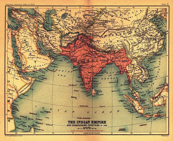
Image: BritishIndianEmpireandEnvirons2
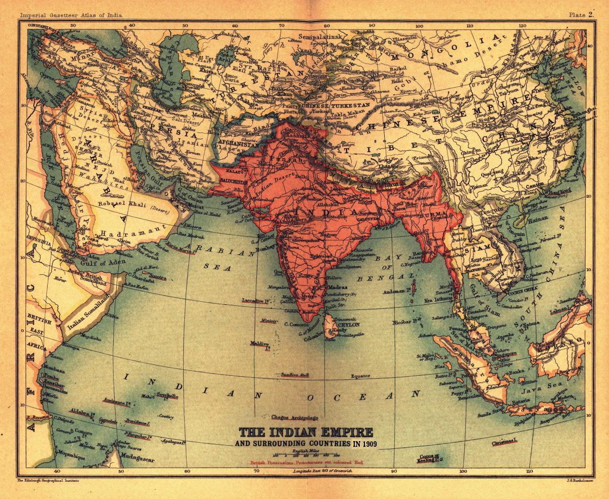
Size of this preview: 731 × 599 pixels. Other resolutions: 293 × 240 pixels | 1,200 × 984 pixels.
Original image (1,200 × 984 pixels, file size: 338 KB, MIME type: image/jpeg)
Description: Map, "The Indian Empire and surrounding countries" (1909), Imperial Gazetteer of India.
Title: BritishIndianEmpireandEnvirons2
Credit: Scanned and reduced from personal copy by Fowler&fowler«Talk» 21:35, 18 March 2008 (UTC)
Usage Terms: Public domain in the United States
License: PD-US
License Link: //en.wikipedia.org/wiki/File:BritishIndianEmpireandEnvirons2.jpg
Image usage
The following 3 pages link to this image:

All content from Kiddle encyclopedia articles (including the article images and facts) can be freely used under Attribution-ShareAlike license, unless stated otherwise.