
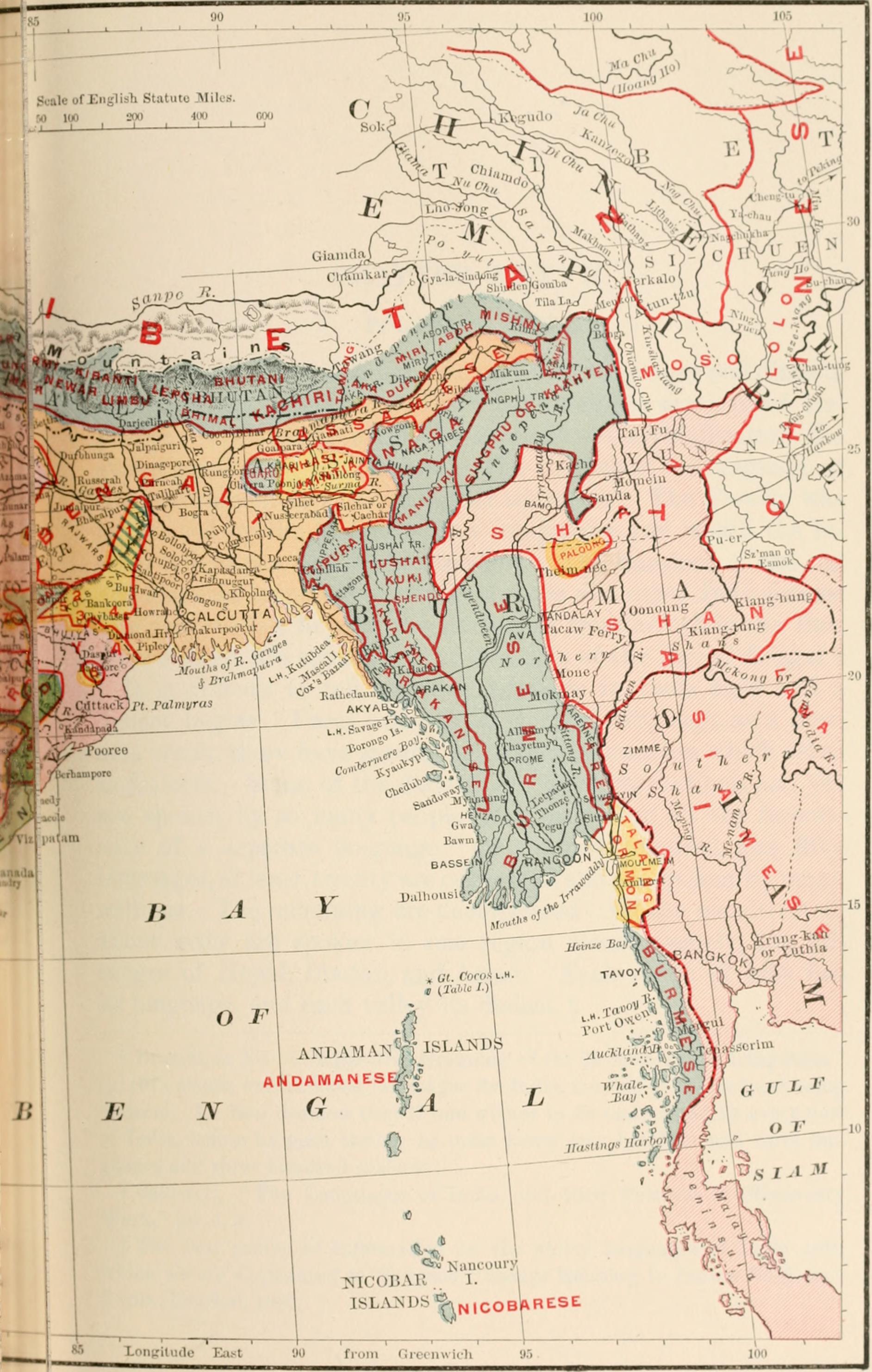
Image: British India map of Northeast India and Myanmar, Bengal Assam Meghalaya Arunachal Pradesh Nagaland Manipur Mizoram Tripura regions 1891
Size of this preview: 381 × 600 pixels. Other resolutions: 152 × 240 pixels | 1,884 × 2,966 pixels.
Original image (1,884 × 2,966 pixels, file size: 630 KB, MIME type: image/jpeg)
Description: Language map
There are about one hundred and fifty languages and dialects spoken by the natives of India. There are seven chief languages.
Source: page 374 of "Indika. The country and the people of India and Ceylon" (1891) Author: John Fletcher Hurst (1834-1903) Publisher: Harper, New York
Author: Internet Archive Book Images
Usage Terms: Creative Commons Attribution-Share Alike 3.0
License: CC-BY-SA-3.0
License Link: http://creativecommons.org/licenses/by-sa/3.0/
Attribution Required?: Yes
Image usage
The following page links to this image:

All content from Kiddle encyclopedia articles (including the article images and facts) can be freely used under Attribution-ShareAlike license, unless stated otherwise.