
Image: Bull run river oregon watershed map
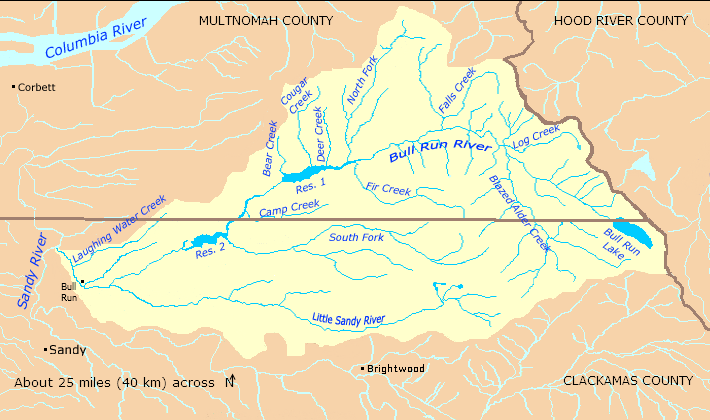
Description: Map of the Bull Run River watershed — in Multnomah and Clackamas counties of northern Oregon, Western United States. A tributary of the Columbia River via the Sandy River. The river begins to the west and within sight of Mount Hood in the Cascade Range (does not drain it) in the Mount Hood National Forest, and flows into the Sandy River between the city of Sandy and the Columbia River.
Title: Bull run river oregon watershed map
Credit: Taken from U.S. Census website here and modified by User:Finetooth. Watershed boundaries from the Sandy River Basin Partners here. City and community locations from Oregon Atlas and Gazetteer (2008), DeLorme Mapping, pp. 29–30, ISBN 0-89933-347-8.
Author: U.S. Census, Finetooth
Permission: U.S. government work in public domain; my modifications licensed under GFDL, CC-BY-SA-3.0
Usage Terms: Public domain
License: Public domain
Attribution Required?: No
Image usage
The following 5 pages link to this image:
