
Image: Bwiairportmap
Size of this preview: 598 × 600 pixels. Other resolutions: 239 × 240 pixels | 1,000 × 1,003 pixels.
Original image (1,000 × 1,003 pixels, file size: 431 KB, MIME type: image/png)
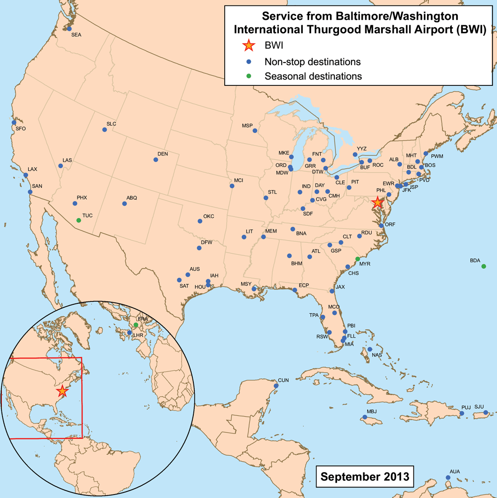
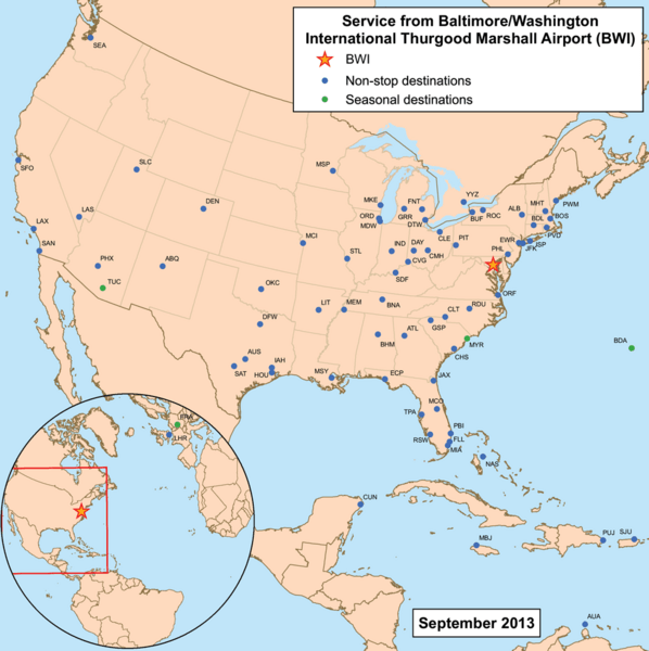
Description: This is a route map for Baltimore-Washington International Thurgood Marshall Airport serving the Baltimore-Washington Metropolitan Area. Map is an Azimuthal equidistant projection centered on the airport so straight lines from BWI are along great circle routes. Source.
Title: Bwiairportmap
Credit: No machine-readable source provided. Own work assumed (based on copyright claims).
Author: No machine-readable author provided. Kmusser assumed (based on copyright claims).
Usage Terms: Creative Commons Attribution-Share Alike 3.0
License: CC BY-SA 3.0
License Link: http://creativecommons.org/licenses/by-sa/3.0
Attribution Required?: Yes
Image usage
The following page links to this image:

All content from Kiddle encyclopedia articles (including the article images and facts) can be freely used under Attribution-ShareAlike license, unless stated otherwise.