
Image: C73193s5 Ant.Map Mount Murchison
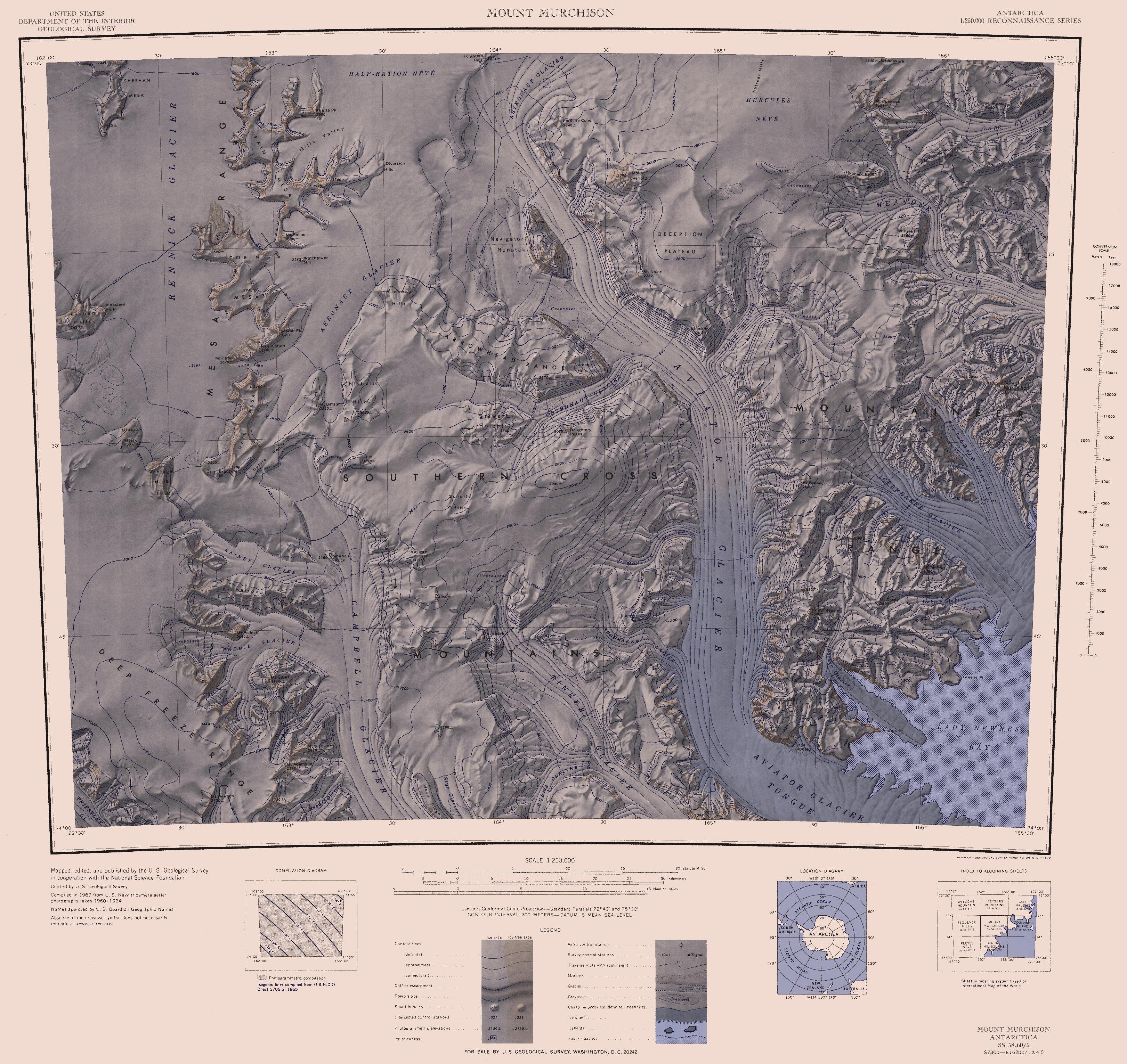
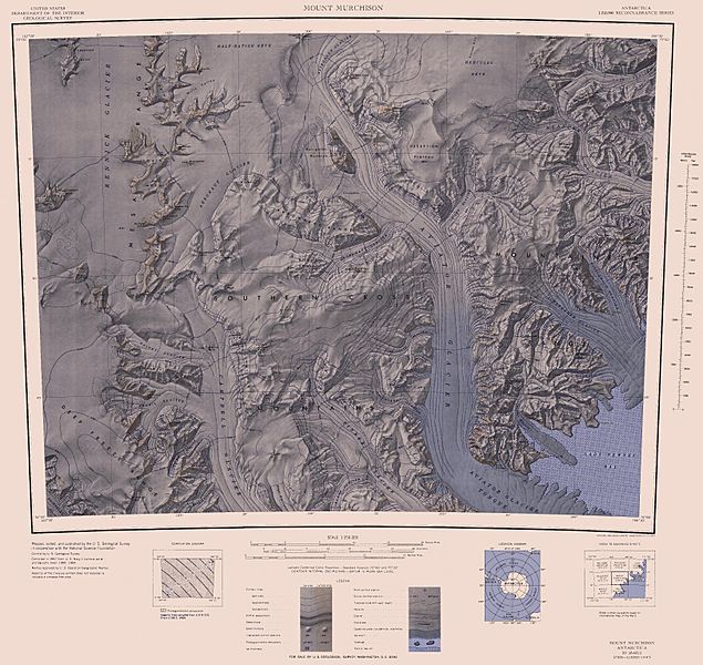
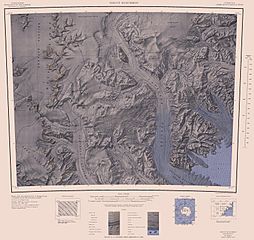
Description: 1:250,000-scale topographic reconnaissance map of the Southern Cross Mountains area from 162°-166°30'E to 73°-74°S in Antarctica, including the Mountaineer Range with Mount Murchison, and Aviator and Campbell Glaciers. Mapped, edited and published by the U.S. Geological Survey in cooperation with the National Science Foundation.
Title: C73193s5 Ant.Map Mount Murchison
Credit: http://usarc.usgs.gov/drg_dload.shtml
Author: United States Geological Survey
Permission: This image is in the public domain in the United States because it only contains materials that originally came from the United States Geological Survey, an agency of the United States Department of the Interior. For more information, see the official USGS copyright policy.
Usage Terms: Public domain
License: Public domain
Attribution Required?: No
Image usage
The following page links to this image:
