
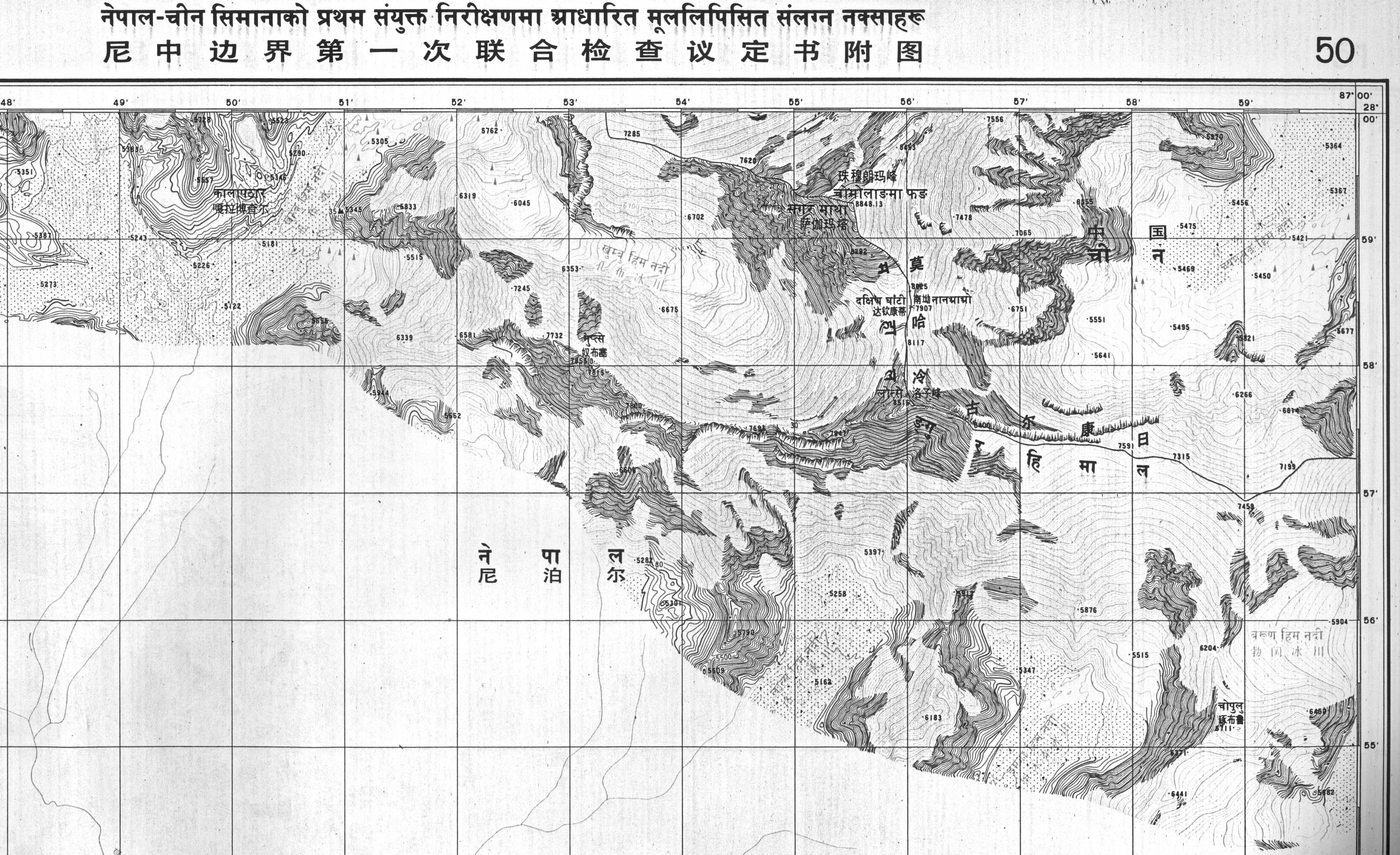
Image: CH-NP 79-80 Bdy Map50
Size of this preview: 800 × 489 pixels. Other resolutions: 320 × 195 pixels | 3,216 × 1,964 pixels.
Original image (3,216 × 1,964 pixels, file size: 1.11 MB, MIME type: image/jpeg)
Description: Boundary maps in the public domain published by the Survey of Nepal, sent to the UN
Title: CH-NP 79-80 Bdy Map50
Credit: Boundary treaty maps held at UN Treaty Office
Author: Survey of Nepal
Usage Terms: Public domain
License: Public domain
Attribution Required?: No
Image usage
The following page links to this image:

All content from Kiddle encyclopedia articles (including the article images and facts) can be freely used under Attribution-ShareAlike license, unless stated otherwise.