
Image: California Bay Area county map (zoom&color)

Size of this PNG preview of this SVG file: 512 × 529 pixels. Other resolution: 232 × 240 pixels.
Original image (SVG file, nominally 512 × 529 pixels, file size: 251 KB)
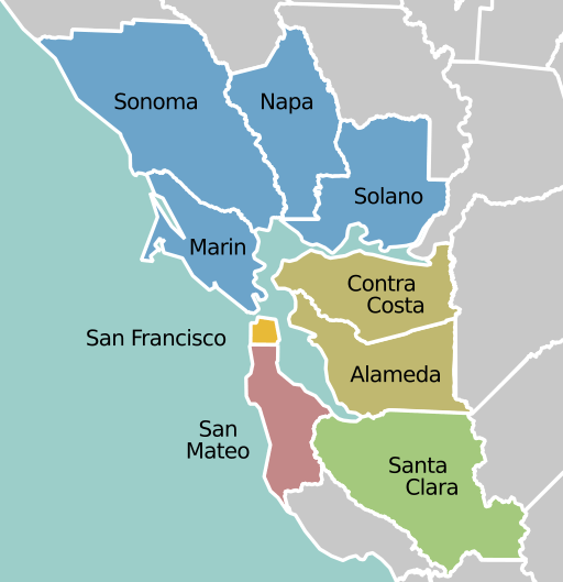
Description: San Francisco Bay Area nine-county map, color coded by region: North Bay East Bay San Francisco Peninsula South Bay
Title: California Bay Area county map (zoom&color)
Credit: color scheme: File:Bayarea map.svg vector source: File:California Bay Area county map.svg this combination: Own work
Author: color scheme: PerryPlanet at English Wikivoyage vector source: GEreikat at English Wikipedia this combination: Mliu92
Usage Terms: Creative Commons Attribution-Share Alike 4.0
License: CC BY-SA 4.0
License Link: http://creativecommons.org/licenses/by-sa/4.0
Attribution Required?: Yes
Image usage
The following page links to this image:

All content from Kiddle encyclopedia articles (including the article images and facts) can be freely used under Attribution-ShareAlike license, unless stated otherwise.
.svg)