
Image: Canada Newfoundland and Labrador Density 2016
Size of this preview: 408 × 599 pixels. Other resolutions: 163 × 240 pixels | 4,295 × 6,302 pixels.
Original image (4,295 × 6,302 pixels, file size: 5.93 MB, MIME type: image/png)
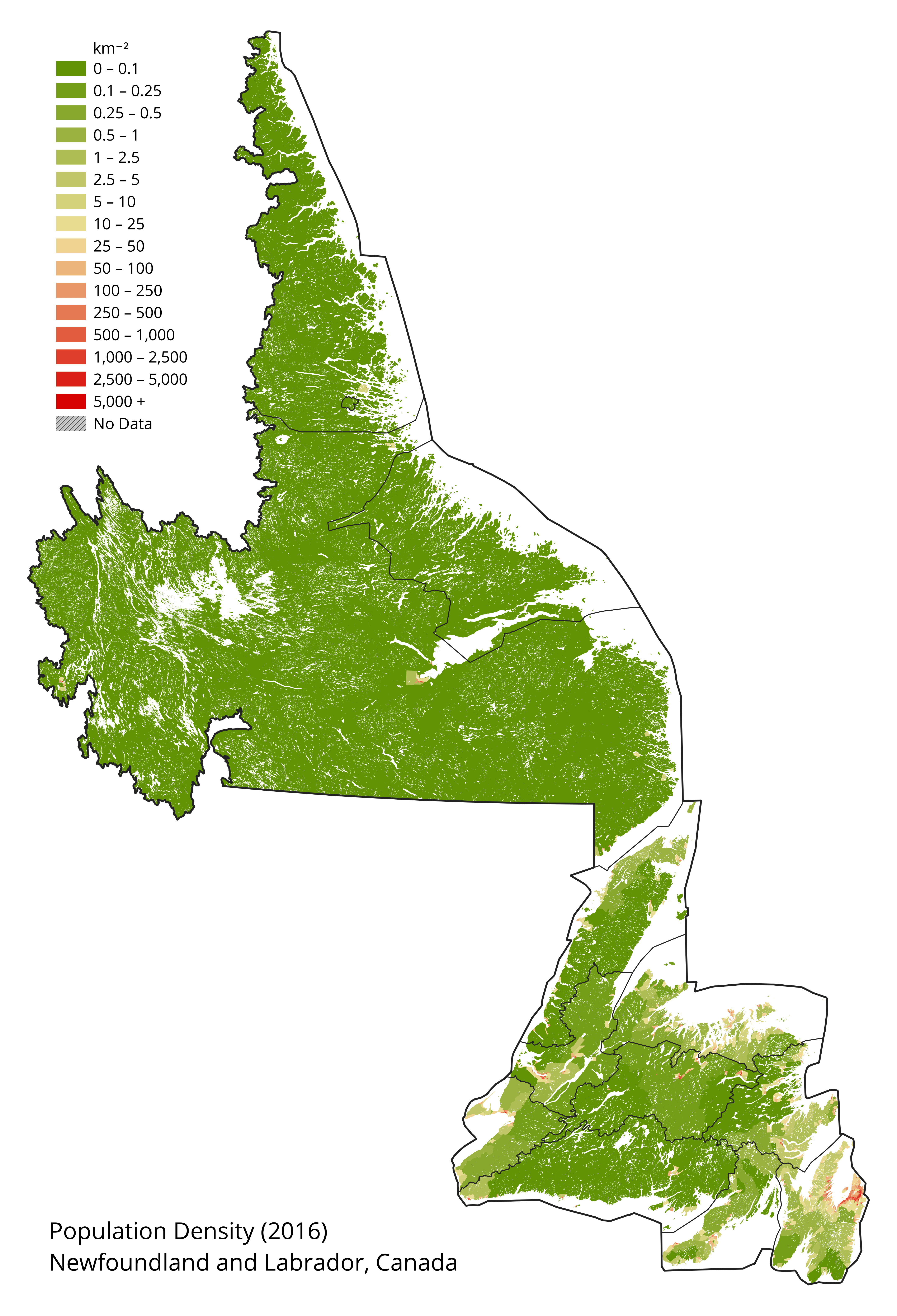
Description: Population density map of Newfoundland and Labrador, Canada. Boundary open data and final counts from Canadian 2016 Census accessed on April 22 2018. Waterbodies from WWF HydroLAKES database.
Usage Terms: Public domain
Image usage
The following 2 pages link to this image:

All content from Kiddle encyclopedia articles (including the article images and facts) can be freely used under Attribution-ShareAlike license, unless stated otherwise.