
Image: Canada provinces 1867-1870
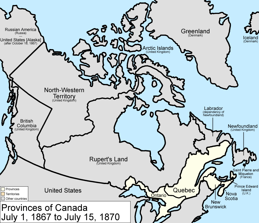
Description: Map of the provinces of Canada as they were from 1867 to 1870. On July 1 1867, the Dominion of Canada was created from three provinces of British North America: Canada (split into the provinces of Ontario and Quebec), New Brunswick, and Nova Scotia. On July 15 1870, Rupert's Land and the North-Western Territories were ceded to Canada, and became the North-West Territories; a small square of this was made the province of Manitoba. Note that, to make for simpler mapping, the western and southwestern portions of the 1927 Privy Council "Coast of Labrador" boundary is used. For the southern boundary, from River Romaine east, Quebec's version of the boundary is used. Until 1927, Canada recognized only a tiny sliver along the Atlantic Ocean as belonging to Newfoundland. Made by User:Golbez.
Title: Canada provinces 1867-1870
Credit: No machine-readable source provided. Own work assumed (based on copyright claims).
Author: No machine-readable author provided. Golbez assumed (based on copyright claims).
Usage Terms: Creative Commons Attribution 2.5
License: CC BY 2.5
License Link: http://creativecommons.org/licenses/by/2.5
Attribution Required?: Yes
Image usage
The following 4 pages link to this image:
