
Image: Canada topo
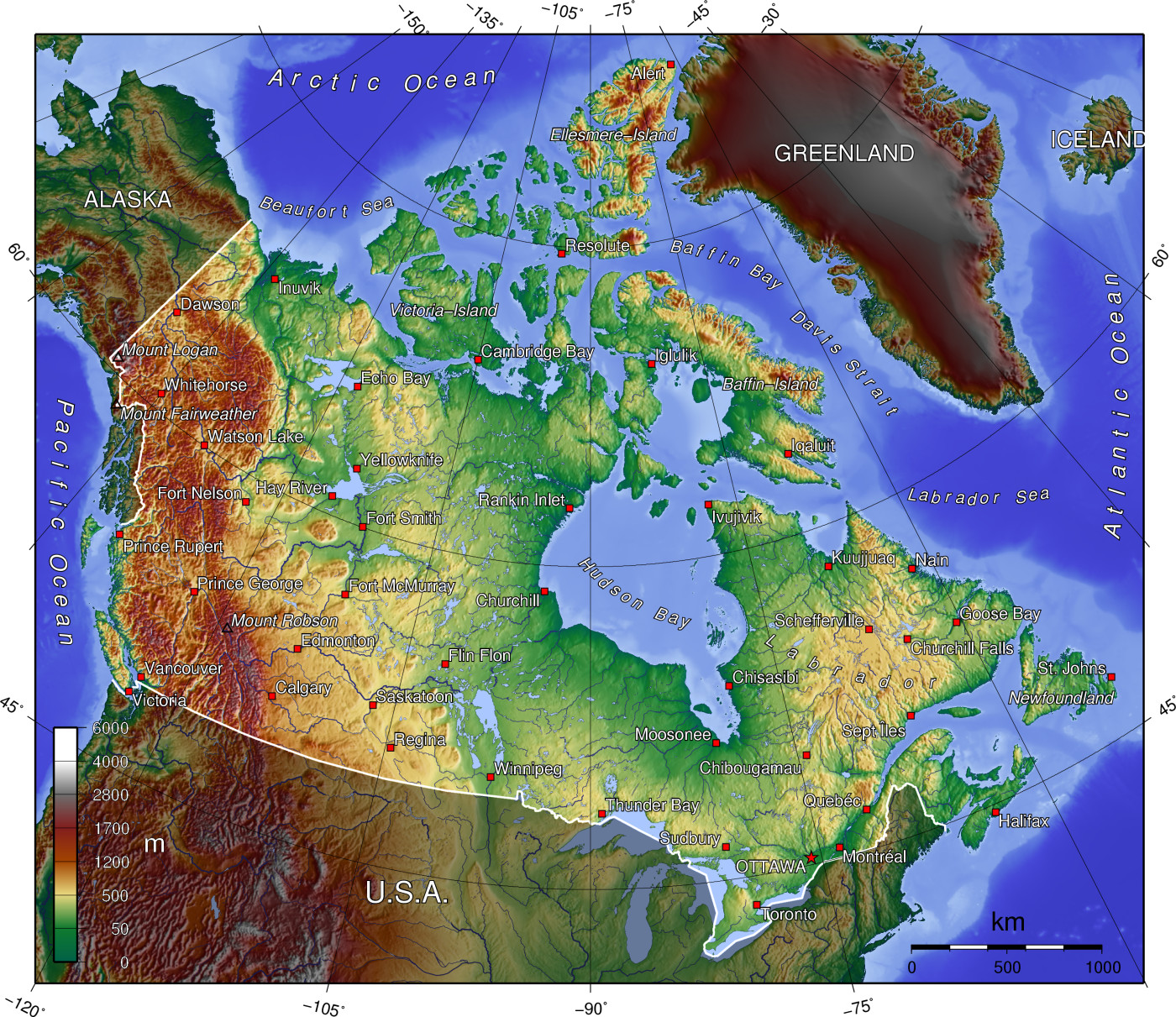
Description: A topographic map of Canada, in polar projection (for 90° W), showing elevations shaded from green to brown (higher), with elevation-legend overlaid at lower left. Nearby countries are shaded darker (compare elevation shades at Canadian borders). The image is centered over longitude 90° W, with longitude meridians at 15-degree intervals apart, and latitude parallels also 15-degree. The boundaries are roughly from longitude 10°W to 177°W, and latitude 40°N to 84°N (above northern-most Alert, Canada 82°28′N, 62°30′W).
Title: Canada topo
Credit: From English Wikipedia image of 7-July-2005, same name: en:Image:Canada topo.jpg (which now points here to Commons).
Author: User:Anchjo (from en:Wikipedia User:Captain_Blood)
Usage Terms: Creative Commons Attribution-Share Alike 3.0
License: CC-BY-SA-3.0
License Link: http://creativecommons.org/licenses/by-sa/3.0/
Attribution Required?: Yes
Image usage
The following 2 pages link to this image:
