
Image: Canddmap
No higher resolution available.
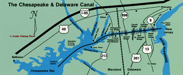
Canddmap.png (639 × 262 pixels, file size: 231 KB, MIME type: image/png)
Description: C&D Canal Map Delaware State Highway 896 is now also part of US 301, and Conrail is now Norfolk Southern here. "New St. Georges Bridge" is Delaware State Highway 1 and also now US 13.
Title: Canddmap
Credit: Image taken from the public domain US Corps of Engineers Chesapeake and Delaware Canal website (http://www.nap.usace.army.mil/sb/c&d.htm) Transferred from en.wikipedia
Author: United States Army Corps of Engineers
Usage Terms: Public domain
License: Public domain
Attribution Required?: No
Image usage
The following page links to this image:

All content from Kiddle encyclopedia articles (including the article images and facts) can be freely used under Attribution-ShareAlike license, unless stated otherwise.