
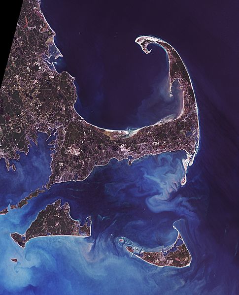
Image: Cape Cod - Landsat 7

Description: Cape Cod (or simply The Cape) is an arm-shaped peninsula forming the Easternmost portion of the Commonwealth of Massachusetts, USA, in the Northeastern United States. It is coextensive with Barnstable County. Although Cape Cod was originally connected to the mainland, the Cape Cod Canal, completed in 1914, effectively transformed Cape Cod into a large island.
Title: Cape Cod - Landsat 7
Credit: Data from USGS GloVis server http://glovis.usgs.gov/. Landsat Orthorectified data generated through NASA's Commercial Remote Sensing Program.
Author: Data: NASA. Image: Dave Pape
Permission: Original data PD-NASA; any copyright that exists from my creation of this image is dedicated to the public domain (PD-SELF)
Usage Terms: Public domain
License: Public domain
Attribution Required?: No
Image usage
The following 2 pages link to this image:
