
Image: Capebretonmainlandbridge
Size of this preview: 800 × 600 pixels. Other resolutions: 320 × 240 pixels | 4,000 × 3,000 pixels.
Original image (4,000 × 3,000 pixels, file size: 1.66 MB, MIME type: image/jpeg)
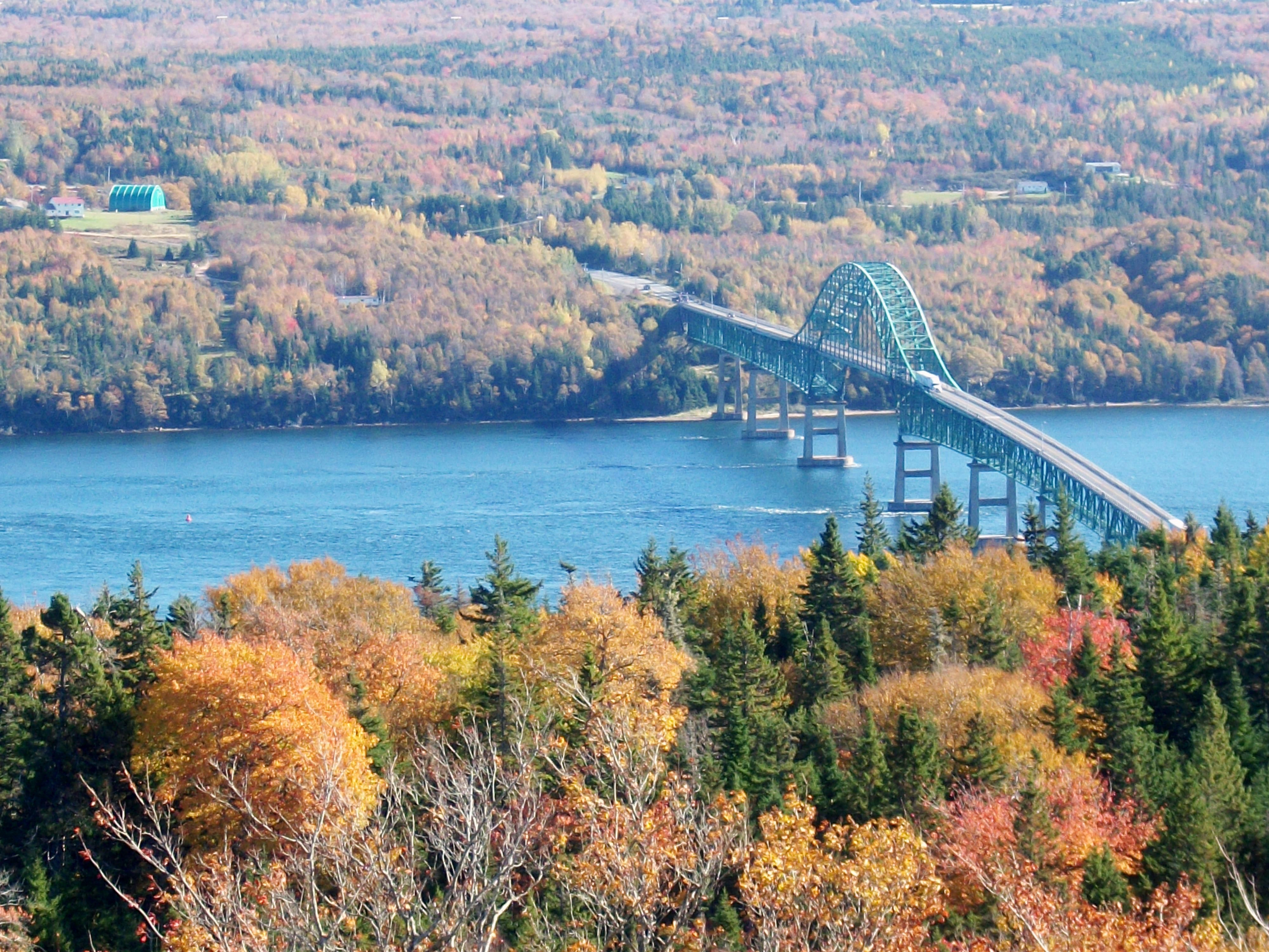
Description: The Seal Island Bridge, the largest bridge on Cape Breton Island, connects the more urban and populated Cape Breton Regional Municipality on the eastern side of the Island, to the rural Victoria County (the boundary is just to the east of the bridge). It is located below Kelly's Mountain on the Trans Canada Highway and spans the Great Bras d'Or channel of the Bras d'Or Lake. It is the 3rd longest bridge in Nova Scotia.[1]
Title: Capebretonmainlandbridge
Credit: Own work
Author: Grmike
Usage Terms: Creative Commons Attribution-Share Alike 3.0
License: CC BY-SA 3.0
License Link: http://creativecommons.org/licenses/by-sa/3.0
Attribution Required?: Yes
Image usage
The following page links to this image:

All content from Kiddle encyclopedia articles (including the article images and facts) can be freely used under Attribution-ShareAlike license, unless stated otherwise.