
Image: Carpathians-satellite
Size of this preview: 624 × 599 pixels. Other resolutions: 250 × 240 pixels | 2,625 × 2,521 pixels.
Original image (2,625 × 2,521 pixels, file size: 2.6 MB, MIME type: image/jpeg)
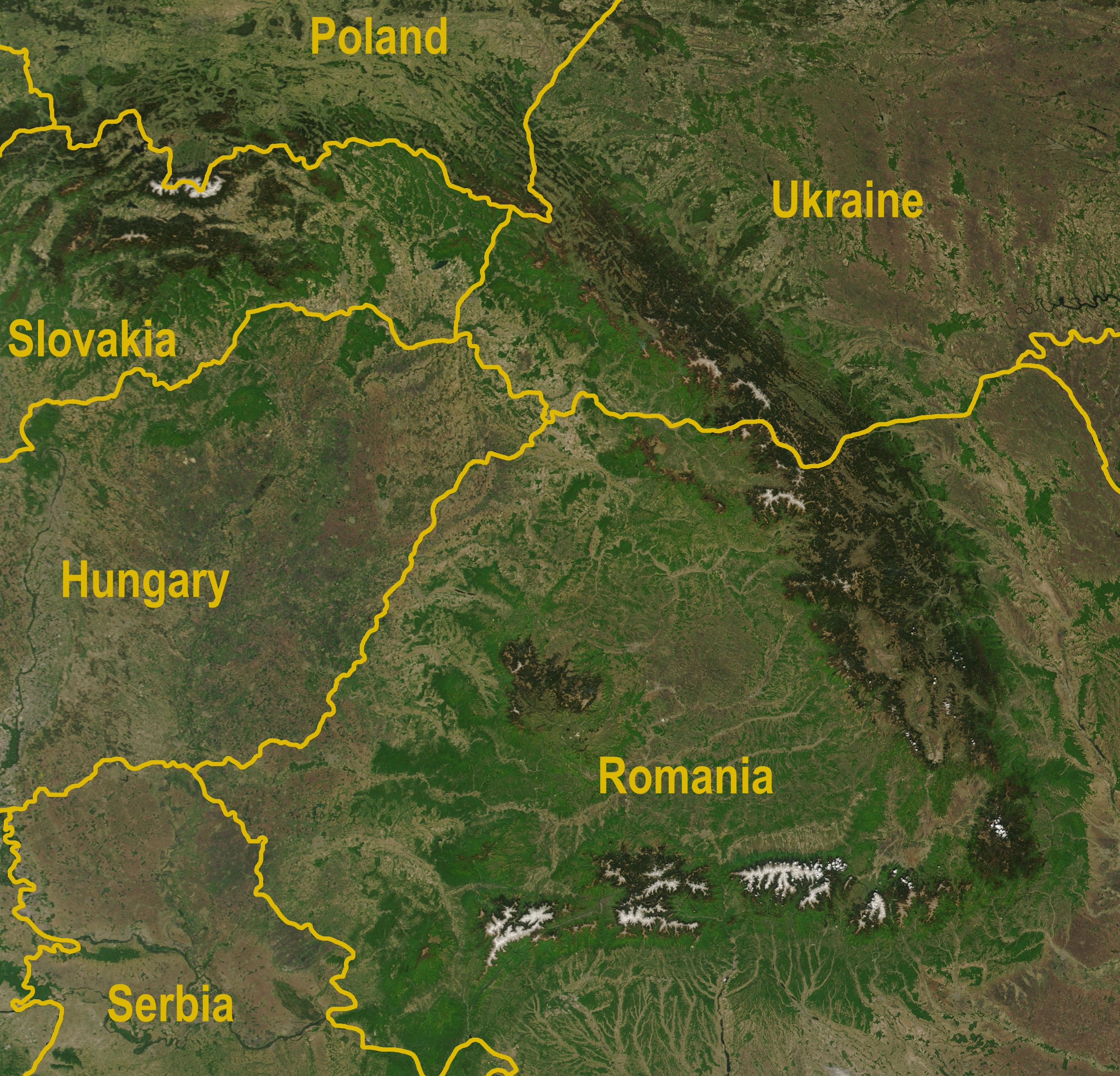
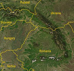
Description: A satellite map of the Carpathians
Title: Carpathians-satellite
Credit: http://visibleearth.nasa.gov/view_rec.php?id=5348 Annotated by Bogdan Giuşcă
Author: Jeff Schmaltz, MODIS Rapid Response Team, NASA/GSFC
Usage Terms: Public domain
License: Public domain
Attribution Required?: No
Image usage
The following page links to this image:

All content from Kiddle encyclopedia articles (including the article images and facts) can be freely used under Attribution-ShareAlike license, unless stated otherwise.