
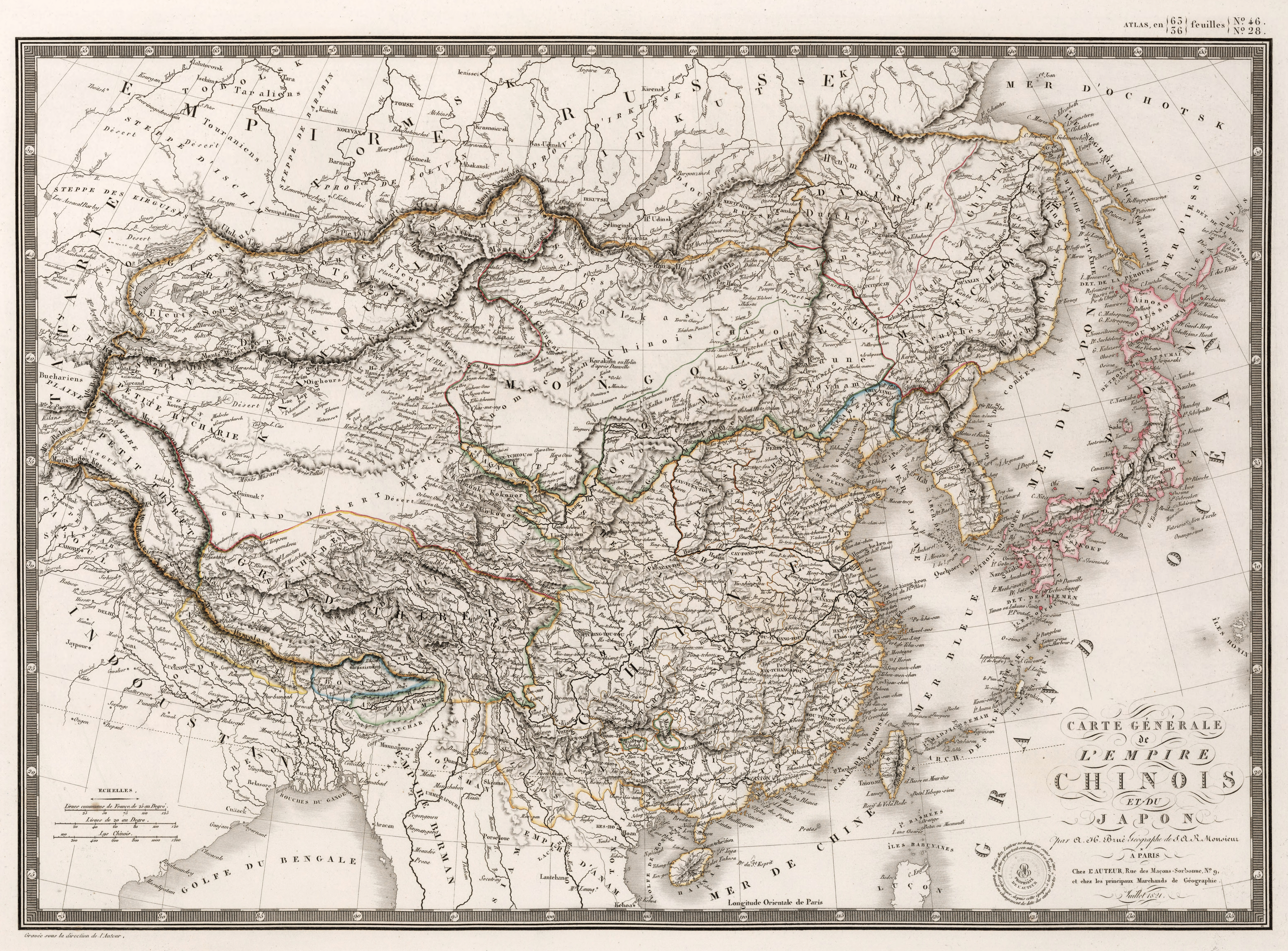
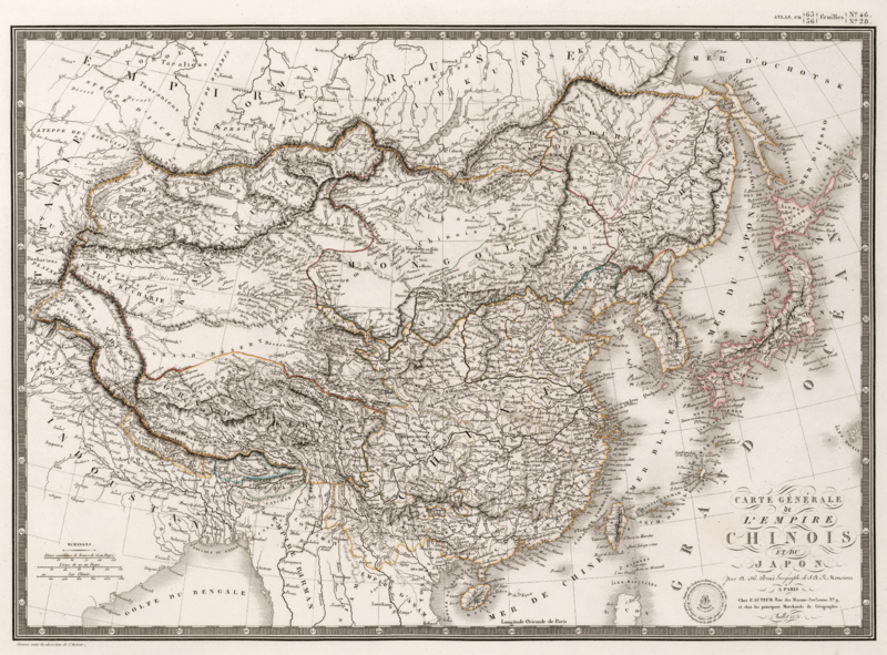
Image: Carte Generale de l'Empire Chinois et du Japon
Description: "General Map of the Chinese Empire and Japan": A map of the Qing Empire and Japan published by J. Andriveau-Goujon at Paris. Note the lower course of the Yellow River prior to the 1850s floods. This map or a somewhat later edition was taken by Huc and Gabet during their historic journey across northern China to Lhasa and back in the early 1840s. Longitude computed relative to Paris.
Title: Carte Generale de l'Empire Chinois et du Japon
Credit: "Carte Generale de l'Empire Chinois et du Japon", p. 32 of Atlas de Choix ou Recueil de Cartes de Geographie Ancienne et Moderne. Hosted at David Rumsey Map Collection.
Author: Adrien-Hubert Brué
Usage Terms: Public domain
License: Public domain
Attribution Required?: No
Image usage
The following page links to this image:
