
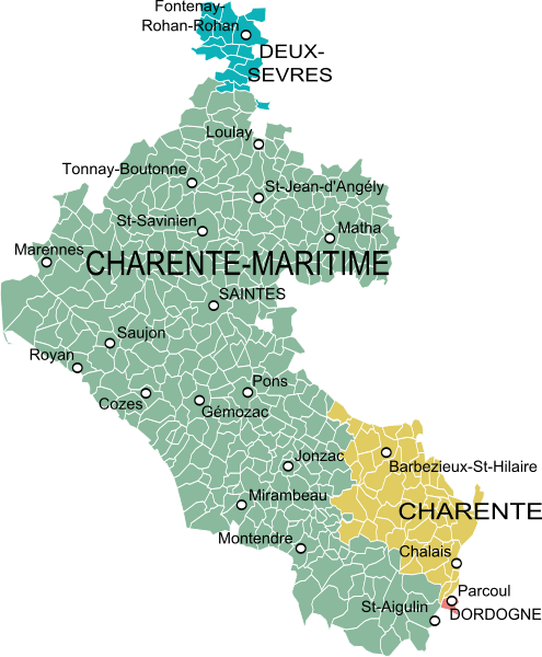
Image: Carte de la Saintonge

Size of this PNG preview of this SVG file: 495 × 600 pixels. Other resolution: 198 × 240 pixels.
Original image (SVG file, nominally 1,381 × 1,673 pixels, file size: 440 KB)
Description: Map of the former province of Saintonge, France, with the current administrative divisions.
Author: Oie blanche
Usage Terms: Creative Commons Attribution-Share Alike 3.0
License: CC-BY-SA-3.0
License Link: http://creativecommons.org/licenses/by-sa/3.0/
Attribution Required?: Yes
Image usage
The following page links to this image:

All content from Kiddle encyclopedia articles (including the article images and facts) can be freely used under Attribution-ShareAlike license, unless stated otherwise.