
Image: Channel Islands IceAge Sealevels
Size of this preview: 800 × 275 pixels. Other resolutions: 320 × 110 pixels | 2,462 × 845 pixels.
Original image (2,462 × 845 pixels, file size: 7.95 MB, MIME type: image/png)
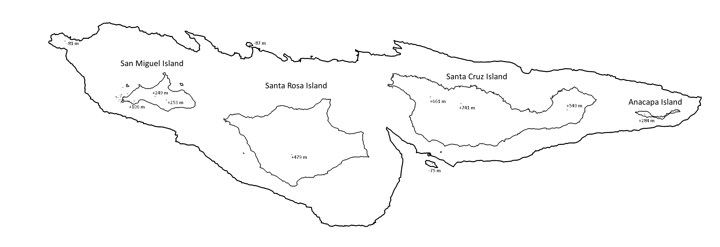
Description: Approximate bathymetric map of the northern Channel Islands at their current sea level, as well as approximately 13,000 years ago when sea levels were 100 meters lower. At this point, all four islands were connected as a single large landmass, with some outlying minor islands just beyond.
Title: Channel Islands IceAge Sealevels
Credit: Own work
Author: Exoplanetaryscience
Usage Terms: Creative Commons Zero, Public Domain Dedication
License: CC0
License Link: http://creativecommons.org/publicdomain/zero/1.0/deed.en
Attribution Required?: No
Image usage
The following page links to this image:

All content from Kiddle encyclopedia articles (including the article images and facts) can be freely used under Attribution-ShareAlike license, unless stated otherwise.