
Image: Charing Cross Map 1890s

Size of this preview: 778 × 600 pixels. Other resolutions: 312 × 240 pixels | 3,616 × 2,787 pixels.
Original image (3,616 × 2,787 pixels, file size: 9.3 MB, MIME type: image/png)
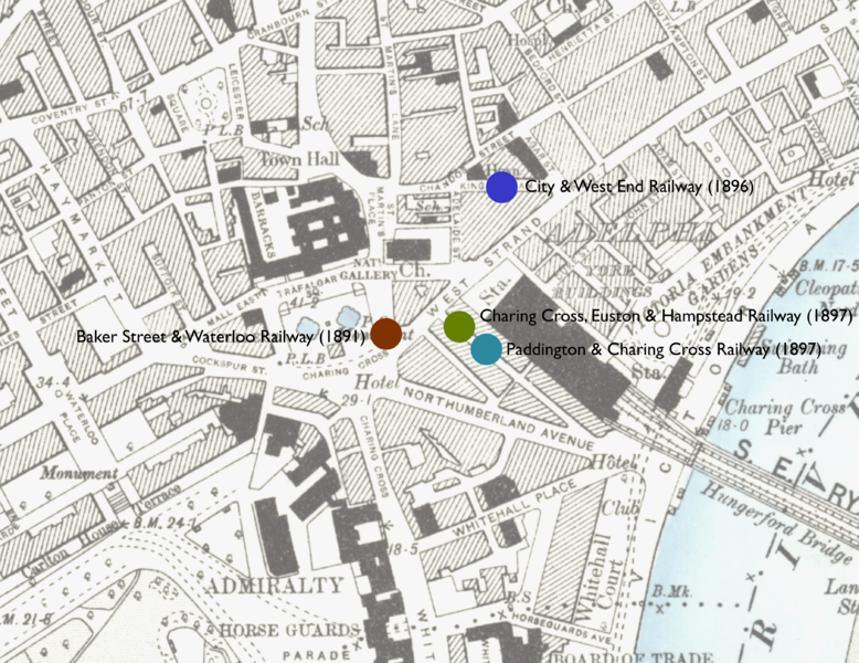
Description: Map showing locations of stations proposed in the 1890s in parliamentary bills for underground stations in the Charing Cross area.
Title: Charing Cross Map 1890s
Credit: Base Map Ordnance Survey map: London VII.SW. Station locations: as described in London's Lost Tube Schemes by Antony Badsey-Ellis
Author: Unknown authorUnknown author
Usage Terms: Public domain
License: Public domain
Attribution Required?: No
Image usage
The following page links to this image:

All content from Kiddle encyclopedia articles (including the article images and facts) can be freely used under Attribution-ShareAlike license, unless stated otherwise.