
Image: Charles Fitch Map
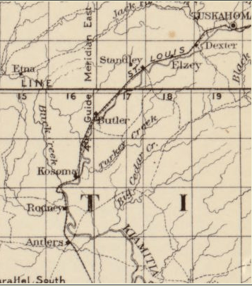
Description: Indian Territory: compiled under the supervision of Charles H. Fitch, topographer in charge of the Indian Territory surveys. Blow-up of specific portion of larger map, to treat as inset. Inset shows modern-day Pushmataha County, Oklahoma.
Title: Charles Fitch Map
Credit: This map is available from the United States Library of Congress's Geography & Map Division under the digital ID g4020.ct002099. This tag does not indicate the copyright status of the attached work. A normal copyright tag is still required. See Commons:Licensing for more information. العربية | čeština | Deutsch | English | español | فارسی | suomi | français | magyar | italiano | македонски | മലയാളം | Nederlands | polski | português | русский | slovenčina | slovenščina | Türkçe | українська | 中文 | 中文(简体) | 中文(繁體) | +/−
Author: Charles H. Fitch, U.S. Department of the Interior
Usage Terms: Public domain
License: Public domain
Attribution Required?: No
Image usage
The following 4 pages link to this image:
