
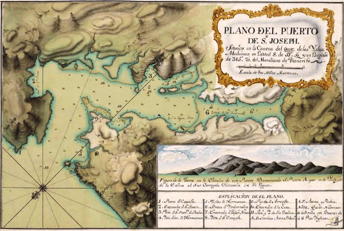
Image: Chatham-Harbour-Weddell-Island-18-century-map
Size of this preview: 800 × 537 pixels. Other resolutions: 320 × 215 pixels | 1,152 × 773 pixels.
Original image (1,152 × 773 pixels, file size: 1.83 MB, MIME type: image/png)
Description: A late 18th century Spanish map of Chatham Harbour, Weddell Island, South Atlantic.
Title: Chatham-Harbour-Weddell-Island-18-century-map
Credit: S.E. Caviglia. Malvinas : Soberanía, Memoria y Justicia : 10 de Junio de 1829. Ministerio de Educación de la Provincia de Chubut, 2012. p. 134
Author: Unknown, late 18th century
Usage Terms: Public domain
License: Public domain
Attribution Required?: No
Image usage
The following 2 pages link to this image:

All content from Kiddle encyclopedia articles (including the article images and facts) can be freely used under Attribution-ShareAlike license, unless stated otherwise.