
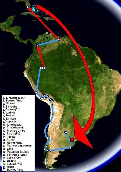
Image: Che Guevara-Granado - Mapa 1er viaje - 1952
No higher resolution available.
Che_Guevara-Granado_-_Mapa_1er_viaje_-_1952.jpg (423 × 600 pixels, file size: 94 KB, MIME type: image/jpeg)
Description: Map of the first voyage of Ernesto Guevara and Alberto Granado. 1952. Red arrows correspond to travel by airplane.
Title: Che Guevara-Granado - Mapa 1er viaje - 1952
Credit: Mapa tomado de World Wind 1.3 (NASA-PD). Itinerario confeccionado por el autor
Author: Pepe Robles
Permission: no need PD
Usage Terms: Public domain
License: Public domain
Attribution Required?: No
Image usage
The following 2 pages link to this image:

All content from Kiddle encyclopedia articles (including the article images and facts) can be freely used under Attribution-ShareAlike license, unless stated otherwise.