
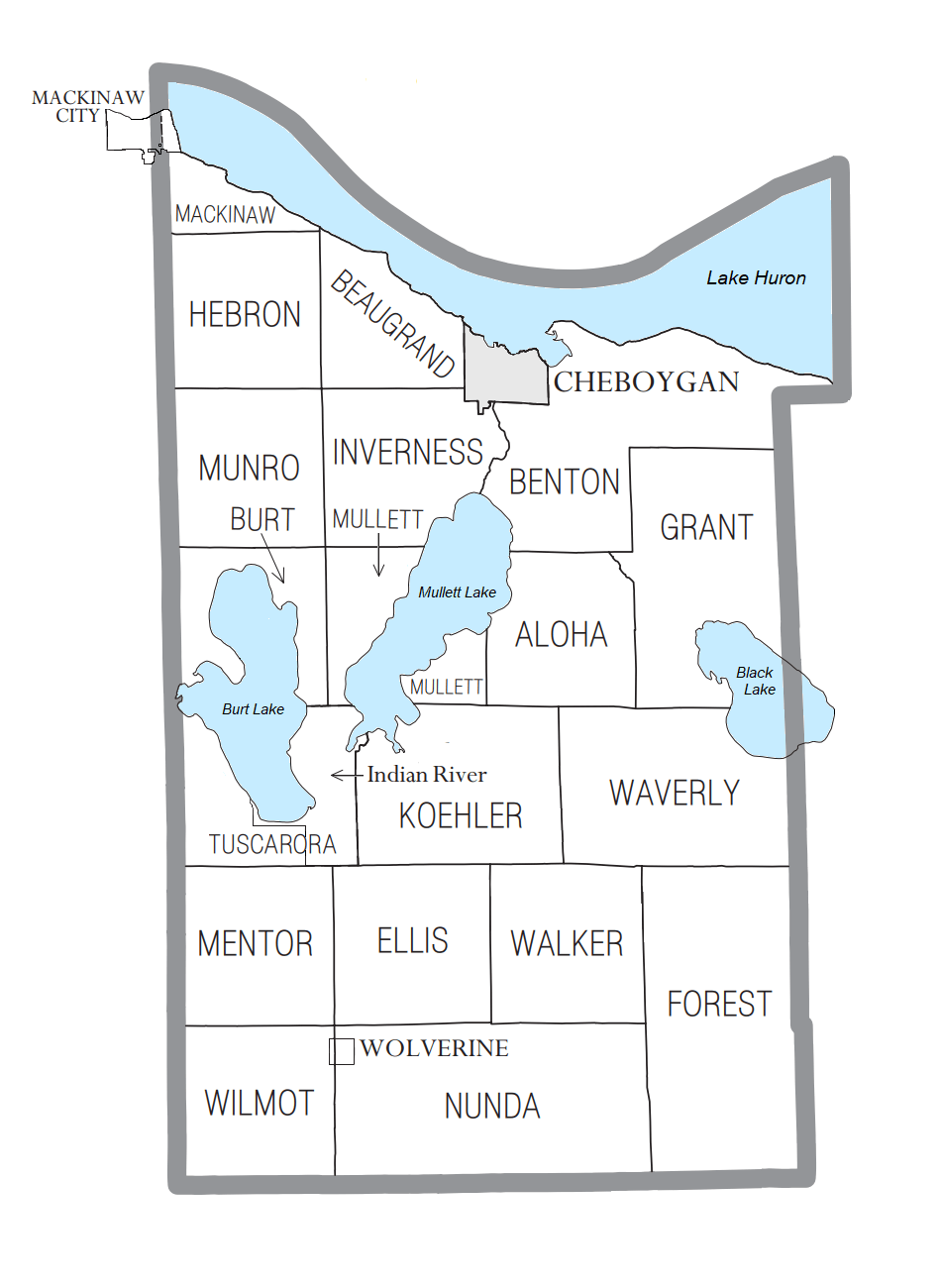
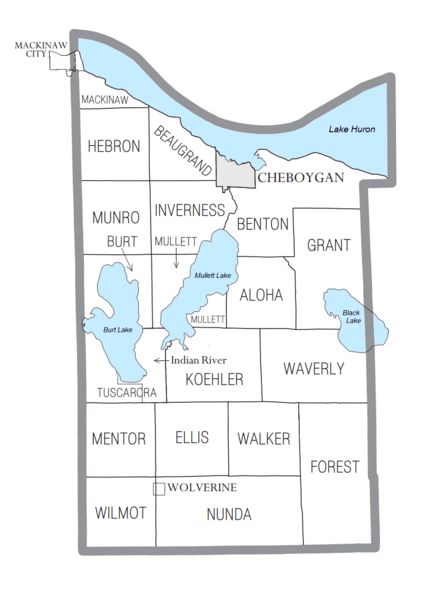
Image: Cheboygan County, MI census map
Size of this preview: 438 × 599 pixels. Other resolutions: 175 × 240 pixels | 950 × 1,300 pixels.
Original image (950 × 1,300 pixels, file size: 65 KB, MIME type: image/png)
Description: Cheboygan County, MI census data map. Does not include the newly-designated CDP of Tower.
Title: Cheboygan County, MI census map
Credit: Own work
Author: Notorious4life (talk) (Uploads)
Usage Terms: Creative Commons Zero, Public Domain Dedication
License: CC0
License Link: http://creativecommons.org/publicdomain/zero/1.0/deed.en
Attribution Required?: No
Image usage
The following page links to this image:

All content from Kiddle encyclopedia articles (including the article images and facts) can be freely used under Attribution-ShareAlike license, unless stated otherwise.