
Image: CherokeeOTSA
No higher resolution available.
CherokeeOTSA.PNG (266 × 139 pixels, file size: 6 KB, MIME type: image/png)
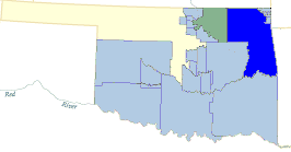
Description: Map of the Cherokee Oklahoma Tribal Statistical Area. Taken from a public domain Census Bureau map, and cropped and recolored somewhat by me.
Title: CherokeeOTSA
Credit: US Census Bureau map
Author: QuartierLatin1968
Permission: This image or file is a work of a United States Census Bureau employee, taken or made as part of that person's official duties. As a work of the U.S. federal government, the image is in the public domain. English | Español | മലയാളം | Русский | Українська | +/−
Usage Terms: Public domain
License: Public domain
Attribution Required?: No
Image usage
The following 2 pages link to this image:

All content from Kiddle encyclopedia articles (including the article images and facts) can be freely used under Attribution-ShareAlike license, unless stated otherwise.