
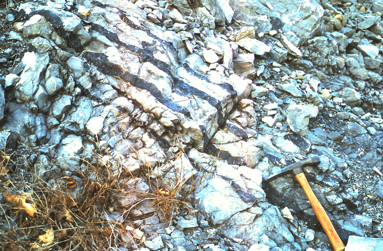
Image: Chert beds EverettPA
Size of this preview: 800 × 524 pixels. Other resolutions: 320 × 210 pixels | 1,245 × 816 pixels.
Original image (1,245 × 816 pixels, file size: 502 KB, MIME type: image/jpeg)
Description: Outcrop of the Devonian Corriganville-New Creek limestone, showing chert (dark bands). Located at U.S. Route 30 (Everett Bypass) roadcut through Warrior Ridge, Bedford County, Pennsylvania. Taken March 2002. See also: Bedford-co-rt30-warrior.jpg
Title: Chert beds EverettPA
Credit: Transferred from en.wikipedia to Commons.
Author: Jstuby at English Wikipedia
Usage Terms: Public domain
License: Public domain
Attribution Required?: No
Image usage
The following page links to this image:

All content from Kiddle encyclopedia articles (including the article images and facts) can be freely used under Attribution-ShareAlike license, unless stated otherwise.