
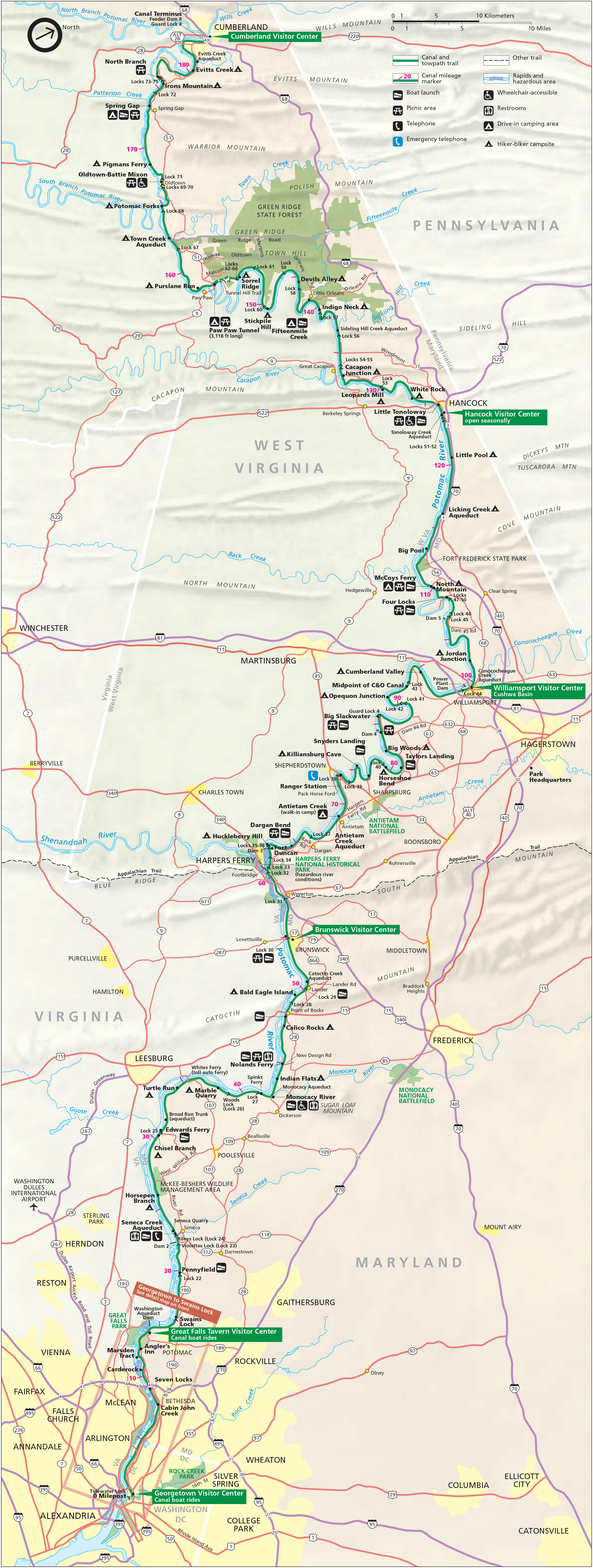
Image: Chesapeake and Ohio Canal National Historical Park (map)
Size of this preview: 226 × 598 pixels. Other resolutions: 90 × 240 pixels | 2,740 × 7,248 pixels.
Original image (2,740 × 7,248 pixels, file size: 6.8 MB, MIME type: image/jpeg)
Description: Map of the Chesapeake and Ohio Canal National Historical Park — along the former Chesapeake and Ohio Canal between Cumberland, Maryland, and Washington, D.C., USA.
Title: Chesapeake and Ohio Canal National Historical Park (map)
Credit: United States National Park Service, website for Chesapeake and Ohio Canal National Historical Park (http://www.nps.gov/choh/planyourvisit/parkmaps.htm).
Author: National Park Service, US Department of the Interior.
Permission: Public domain - original work of the US Federal Government.
Usage Terms: Public domain
License: Public domain
Attribution Required?: No
Image usage
The following page links to this image:

All content from Kiddle encyclopedia articles (including the article images and facts) can be freely used under Attribution-ShareAlike license, unless stated otherwise.
.jpg)