
Image: Chiaves-la-florida-1584

Size of this preview: 800 × 544 pixels. Other resolutions: 320 × 218 pixels | 2,748 × 1,868 pixels.
Original image (2,748 × 1,868 pixels, file size: 665 KB, MIME type: image/jpeg)
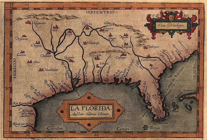
Description: Map of the Spanish province of "La Florida," which included most of the southeastern United States. The map was drawn by Spanish royal cartographer Geronimo Chiaves, and was probably based on accounts by members of the Hernando De Soto expedition (1539-1543). The map was originally published in Abraham Ortelius' Theatrum Orbis Terrarum in 1584.
Title: Chiaves-la-florida-1584
Credit: http://www.loc.gov/exhibits/earlyamericas/online/aftermath/aftermath2.html
Author: Geronimo Chiaves, Abraham Ortelius
Usage Terms: Public domain
License: Public domain
Attribution Required?: No
Image usage
The following page links to this image:

All content from Kiddle encyclopedia articles (including the article images and facts) can be freely used under Attribution-ShareAlike license, unless stated otherwise.