
Image: China GHI mid-size-map 156x152mm-300dpi v20170926

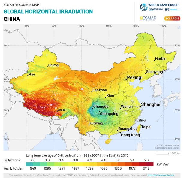
Description: This solar resource map provides a summary of the estimated solar energy available for power generation and other energy applications. It represents the average daily/yearly sum of global horizontal irradiation (GHI). The underlying solar resource database is calculated by the Solargis model from atmospheric and satellite data with 15-minute and 30-minute time step respectively, and a spatial resolution of 1 km. Further details available from: https://globalsolaratlas.info
Title: China GHI mid-size-map 156x152mm-300dpi v20170926
Credit: https://globalsolaratlas.info
Author: World Bank
Usage Terms: Creative Commons Attribution 4.0
License: CC BY 4.0
License Link: https://creativecommons.org/licenses/by/4.0
Attribution Required?: Yes
Image usage
There are no pages that link to this image.
