
Image: China map
Size of this preview: 600 × 600 pixels. Other resolutions: 240 × 240 pixels | 705 × 705 pixels.
Original image (705 × 705 pixels, file size: 135 KB, MIME type: image/png)
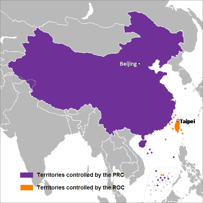
Description: This is a map of the two states that officially use the name "China" in their names and depicts the actual "line of control" and not any claims that states often make. Key words: actual administration and actual maintaining of control of the territories. Avec nat | Wikipédia Prends Des Forces. 03:09, 19 November 2007 (UTC)
Title: China map
Credit: Transferred from en.wikipedia to Commons by Sreejithk2000 using CommonsHelper.
Author: Nat at English Wikipedia
Usage Terms: Creative Commons Attribution 3.0
License: CC BY 3.0
License Link: http://creativecommons.org/licenses/by/3.0
Attribution Required?: Yes
Image usage
The following 3 pages link to this image:

All content from Kiddle encyclopedia articles (including the article images and facts) can be freely used under Attribution-ShareAlike license, unless stated otherwise.