
Image: Chowanrivermap
No higher resolution available.
Chowanrivermap.png (500 × 417 pixels, file size: 156 KB, MIME type: image/png)
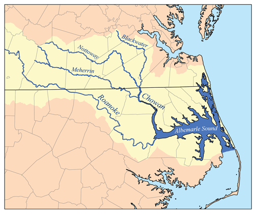
Description: This is a map of eastern portion of the Chowan/Roanoke watershed, showing the Chowan, Meherrin, Nottoway and Blackwater rivers as well as Albemarle Sound. For the western portion of the watershed see Image:RoanokeRiverWatershed.png. I, Karl Musser, created it based on USGS data.
Title: Chowanrivermap
Credit: No machine-readable source provided. Own work assumed (based on copyright claims).
Author: No machine-readable author provided. Kmusser assumed (based on copyright claims).
Usage Terms: Creative Commons Attribution-Share Alike 2.5
License: CC BY-SA 2.5
License Link: http://creativecommons.org/licenses/by-sa/2.5
Attribution Required?: Yes
Image usage
The following 7 pages link to this image:

All content from Kiddle encyclopedia articles (including the article images and facts) can be freely used under Attribution-ShareAlike license, unless stated otherwise.