
Image: Christchurch CTB tramway route map 1950

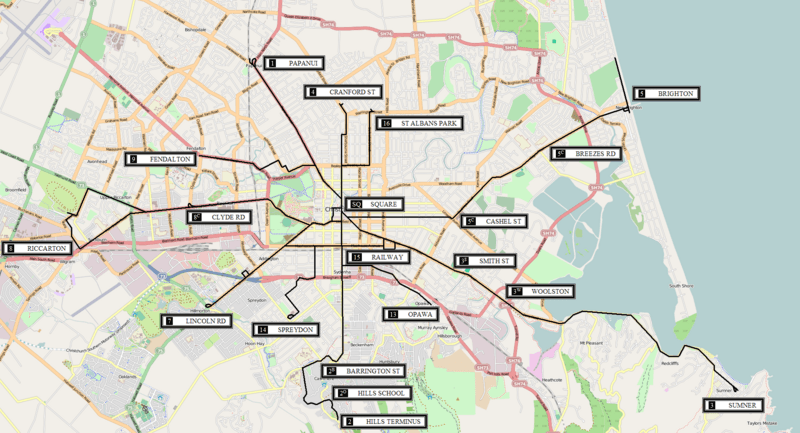
Description: Route map of the Christchurch Tramway Board tramway system in Christchurch, New Zealand as at January 1950. N.B. The base road map used here is for reference only and no attempt has been made to make it commensurate with the era in which the tramway operated.
Title: Christchurch CTB tramway route map 1950
Credit: Own work based on map image from OpenStreetMap. Route information courtesy of: Alexander, Mark; Dew, Les (1993) Tram to the terminus: the Christchurch Tramway Board & its electric tramways 1921–54, Christchurch: A & M Publishers Stewart, Graham (1993) The End Of The Penny Section: When Trams Ruled the Streets of New Zealand, Wellington: Grantham House Publishing Transferred from en.wikipedia by SreeBot
Author: Matthew25187 at en.wikipedia
Permission: Base map image © OpenStreetMap contributors, CC-BY-SA.
Usage Terms: Creative Commons Attribution-Share Alike 3.0
License: CC BY-SA 3.0
License Link: https://creativecommons.org/licenses/by-sa/3.0
Attribution Required?: Yes
Image usage
The following page links to this image:
